
Guide to Búrfellsvirkjun Power Plant
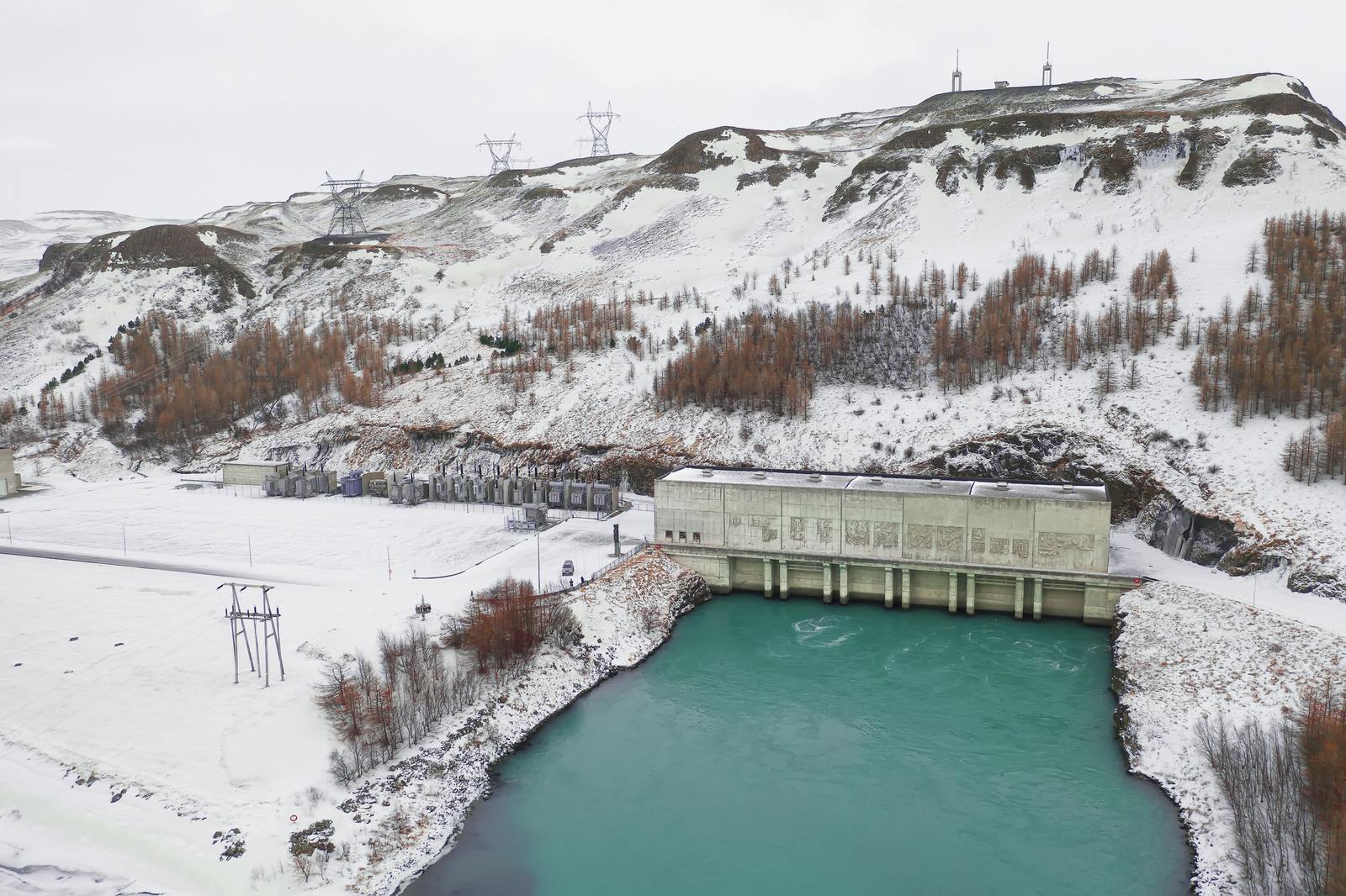
Located at the mouth of the Þjórsárdalur valley, Búrfellsvirkjun is one of the country’s largest hydroelectric power stations. Operated by Landsvirkjun, this hydroelectric power station harnesses the glacial runoff of the Þjórsá, the country’s longest river. Sitting in the shadow of Hekla volcano, the station is an intersection of modern Icelandic engineering and raw volcanic landscape.
History of the Búrfell Hydroelectric Plant
Completed in 1969, Búrfellsvirkjun was the country’s first large-scale hydroelectric project built to support heavy industry, particularly aluminum production. The plant played a crucial role in ushering Iceland into the modern industrial era.
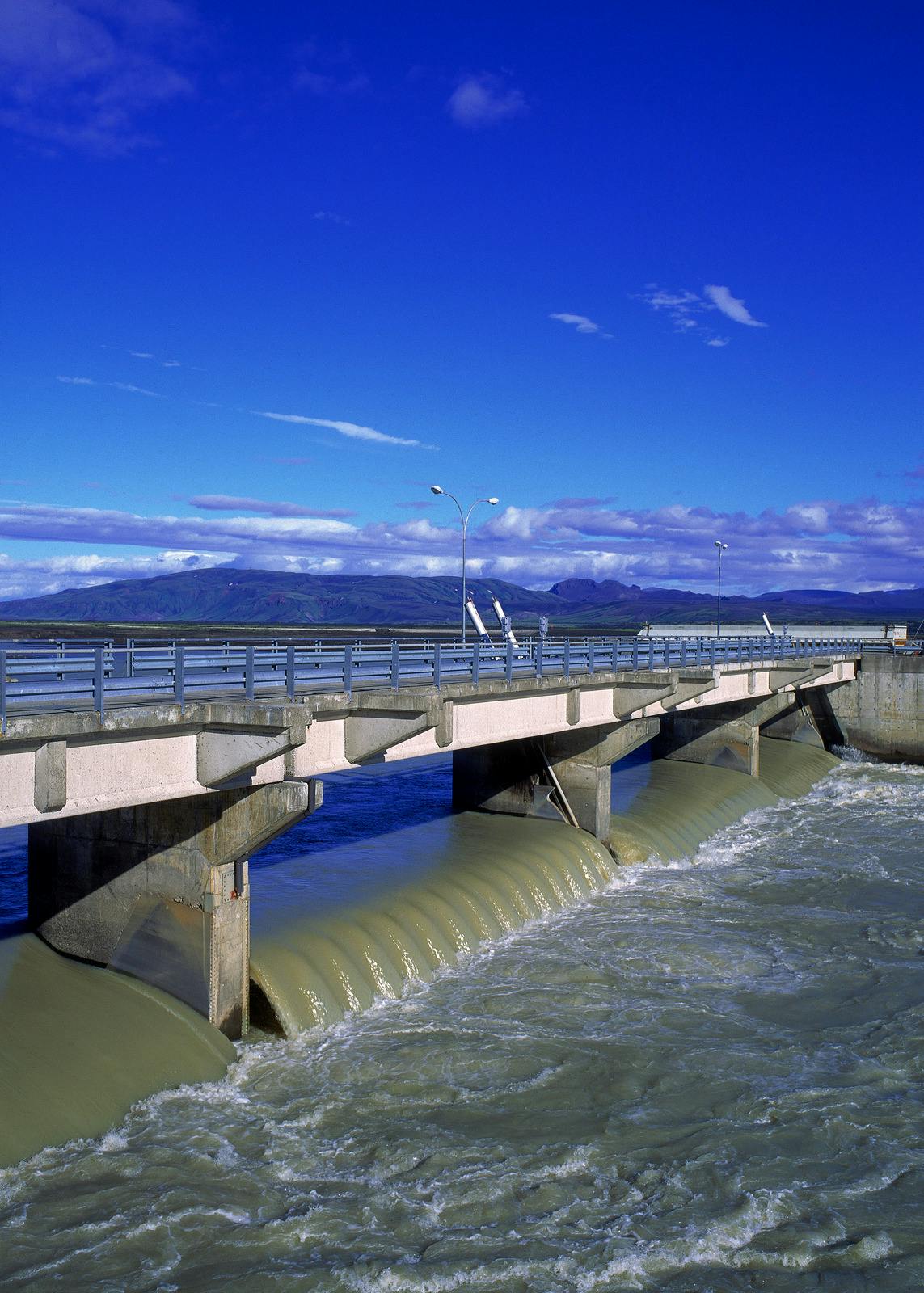
Engineering the station required overcoming unique environmental challenges. The Þjórsá River carries glacial sediment and is prone to slushy ice crystals that can damage equipment. To address this, engineers diverted part of the river into Bjarnalón, a shallow settling basin. Here, sediment and ice can settle or be removed before the water enters a 1-mile (1.5-kilometer) intake tunnel.
Once inside, the water drops 377 feet (115 meters) through pressurized pipes to drive six Francis turbines. After generating power, the water is released back into its natural course near the Hjálparfoss waterfall.
In 2018, the site expanded with Búrfell II Power Station. By placing the new powerhouse entirely underground, the expansion increased output while preserving the surrounding landscape.
For a deeper look at the country’s aquatic world, the Water in Icelandic Nature exhibition at Perlan is a great stop. The exhibit provides interactive insight into how the island’s rivers shape both its environment and economy.
Things to See Near Búrfellsvirkjun
The hydroelectric plant sits within Þjórsárdalur, one of Iceland’s most historically and geologically rich valleys. While the power station itself is industrial, its surroundings are exceptionally scenic.
- Hjálparfoss: A double waterfall near the confluence of the Fossá and Þjórsá rivers. The two cascades frame a striking basalt rock formation before tumbling into a calm plunge pool. It’s highly accessible, with a parking lot just a short walk from the viewpoint.
- Þjóðveldisbærinn Stöng: This reconstructed Viking-Age farmstead is based on a longhouse buried by an eruption of Hekla in 1104. Turf walls, wooden interiors, and a small stave church provide a vivid glimpse into medieval Icelandic life.
- Gjáin: Hailed as a hidden oasis, this small valley is a fairytale landscape of springs, basalt columns, and the multi-tiered Gjárfoss waterfall.
- Reforested Slopes Around Mount Búrfell: The hills near Mount Búrfell are part of one of Iceland’s most successful reforestation efforts. Birch and willow now populate what was once a largely barren volcanic landscape.
- Háifoss: A short drive deeper into the valley leads to Háifoss, one of Iceland’s tallest waterfalls. The access road can be rough, and a 4x4 vehicle is recommended for the final stretch.
How to Get to Búrfellsvirkjun in Iceland
To get to Búrfellsvirkjun from Reykjavík, take the Ring Road (Route 1) east toward the town of Selfoss, then turn left onto Route 30. Follow this road north, then turn right onto Route 32. This scenic road leads directly into the Þjórsárdalur valley.
The drive covers approximately 80 miles (130 kilometers). Roads are paved and accessible for standard 2WD vehicles during the summer, while winter travel may require a 4x4. The power station is a prominent landmark and serves as the perfect jumping-off point for exploring nearby attractions.
Discover Iceland’s Natural Power
Búrfellsvirkjun is a landmark of Icelandic ingenuity, transforming glacial river flow into sustainable electricity. For a broader understanding of the forces shaping the island, a visit to the Forces of Nature exhibition at Perlan in Reykjavík provides valuable context. Through immersive displays, visitors gain insight into volcanoes, earthquakes, glaciers, and rivers that continue to define Iceland’s landscape and infrastructure.
FAQs About Búrfellsvirkjun
Can you tour Búrfellsvirkjun?
The active industrial areas are generally closed to the public. However, Landsvirkjun operates a visitor center during the summer, where guests can learn about hydropower production and the plant’s history.
Where does 100% of the electricity in Iceland come from?
Iceland generates nearly all of its electricity from renewable resources, with approximately 70% from hydropower and about 30% from geothermal energy. Wind energy is emerging but currently represents a very small share.
Is Búrfellsvirkjun safe to visit in the winter?
Yes, main roads are usually maintained, but snow, ice, and strong winds are common between November and March. A 4x4 vehicle is recommended.
How long should you spend at the site?
A brief stop for photographs typically takes 15 to 20 minutes. If combined with nearby attractions in Þjórsárdalur, plan for two to three hours or more.
Can you see the Hekla volcano from the power plant?
Yes. On clear days, the snow-capped peak of Hekla dominates the southern skyline.
Popular articles
Guide to the Solar Eclipse 2026
Plan your trip to witness the Solar Eclipse 2026 in Iceland! Discover the best viewing spots, key times, safety tips, and travel advice for this rare celestial event.

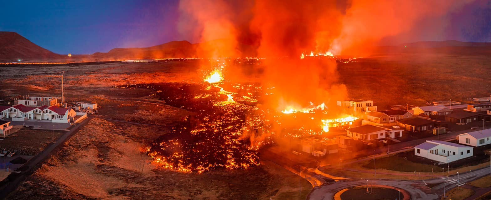
July 2026 updates on the Sundhnúkagígar Eruption in the Reykjanes Peninsula!
The current eruption in the Reykjanes Peninsula, is called Sundhnúkagígar Crater Row. See insights on the seismic activity and volcanic eruptions in the area!
Active Volcanoes in Iceland 2026
Active volcanoes aren't the same thing as active eruptions. A volcano can be considered active even when it is not ejecting ash, rock, gases and magma, so which are active in Iceland in 2026?

Top 10 Places To See the Northern Lights in Iceland
You can see the northern lights across the country, but some spots are more suitable than others. Find the best place to see the northern lights in Iceland.

Ice Caves From Reykjavik
Travel beyond the capital for a closer look at an ice cave under one of Iceland’s glaciers. If you can’t spare the time, experience Perlan’s ice cave in Reykjavik.