
Iceland’s Central Highlands
In the year 1756, Fjalla-Eyvindur, Iceland’s most notorious outlaw, sought refuge in the untamed heart of the Icelandic highlands. Pursued by authorities for theft, he and his wife, Halla, navigated the treacherous terrain, seeking sanctuary amidst the lava fields and glacial valleys.
This story, etched into Icelandic folklore, highlights the very essence of the highlands: a place of remote, formidable beauty, a refuge for those seeking escape from the constraints of civilization, and a test ground for survival skills. Today, the highlands remain a testament to this wild spirit, a place where nature's forces reign supreme.
What and Where Are the Highlands?
The Icelandic Central Highlands cover about 40,000 square kilometers (15,444 square miles), almost half the island. By definition, their lower limits are at 500 m above sea level.
They sit in the center of the country, above the coast, above the trees, above the paved roads. There are no towns here, no farms, and limited winter access. Just volcanic deserts, glaciers, lava fields, rivers, and geothermal heat.
This is one of the largest uninhabited areas in Europe.
Built by Volcanoes and Glaciers
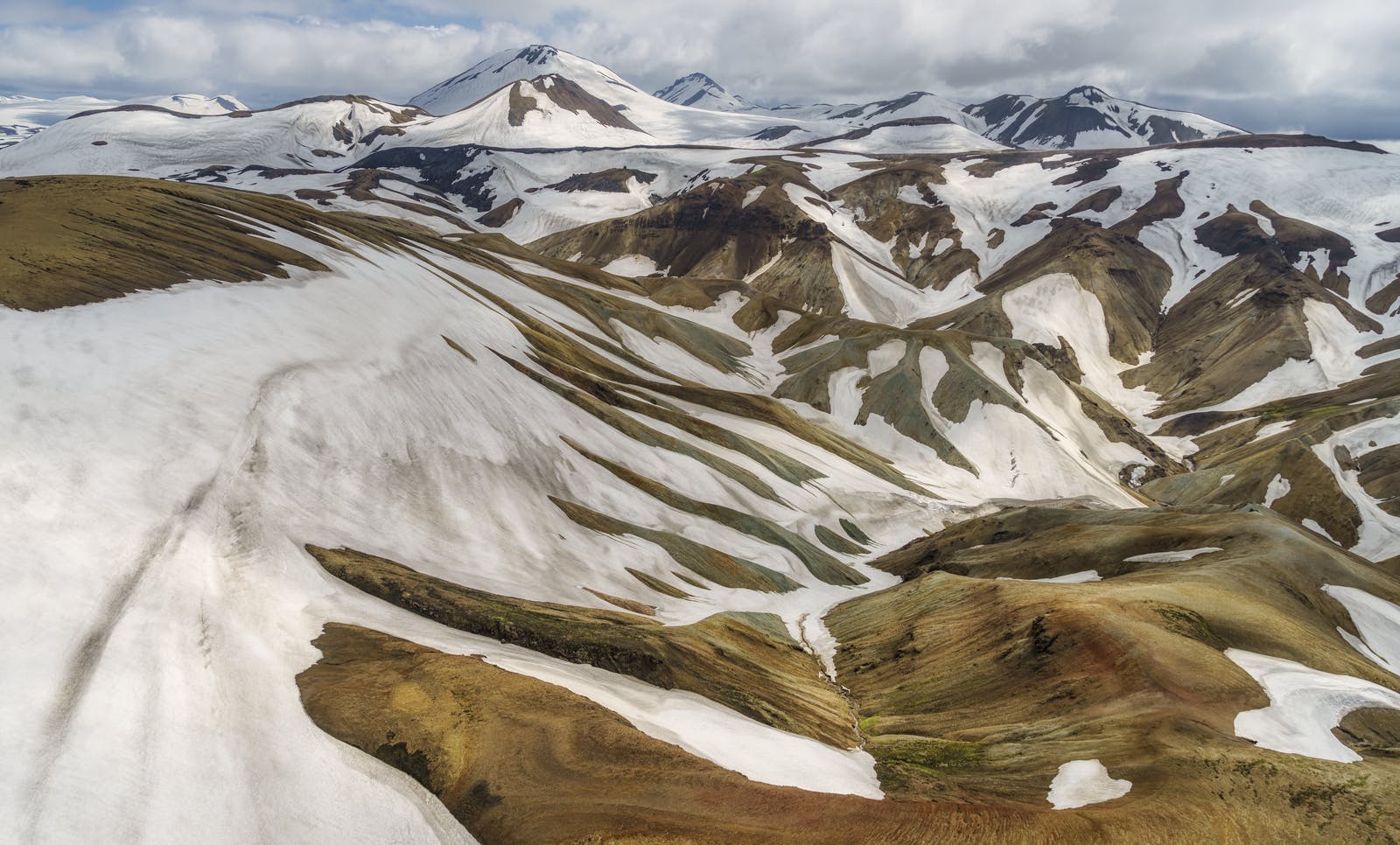
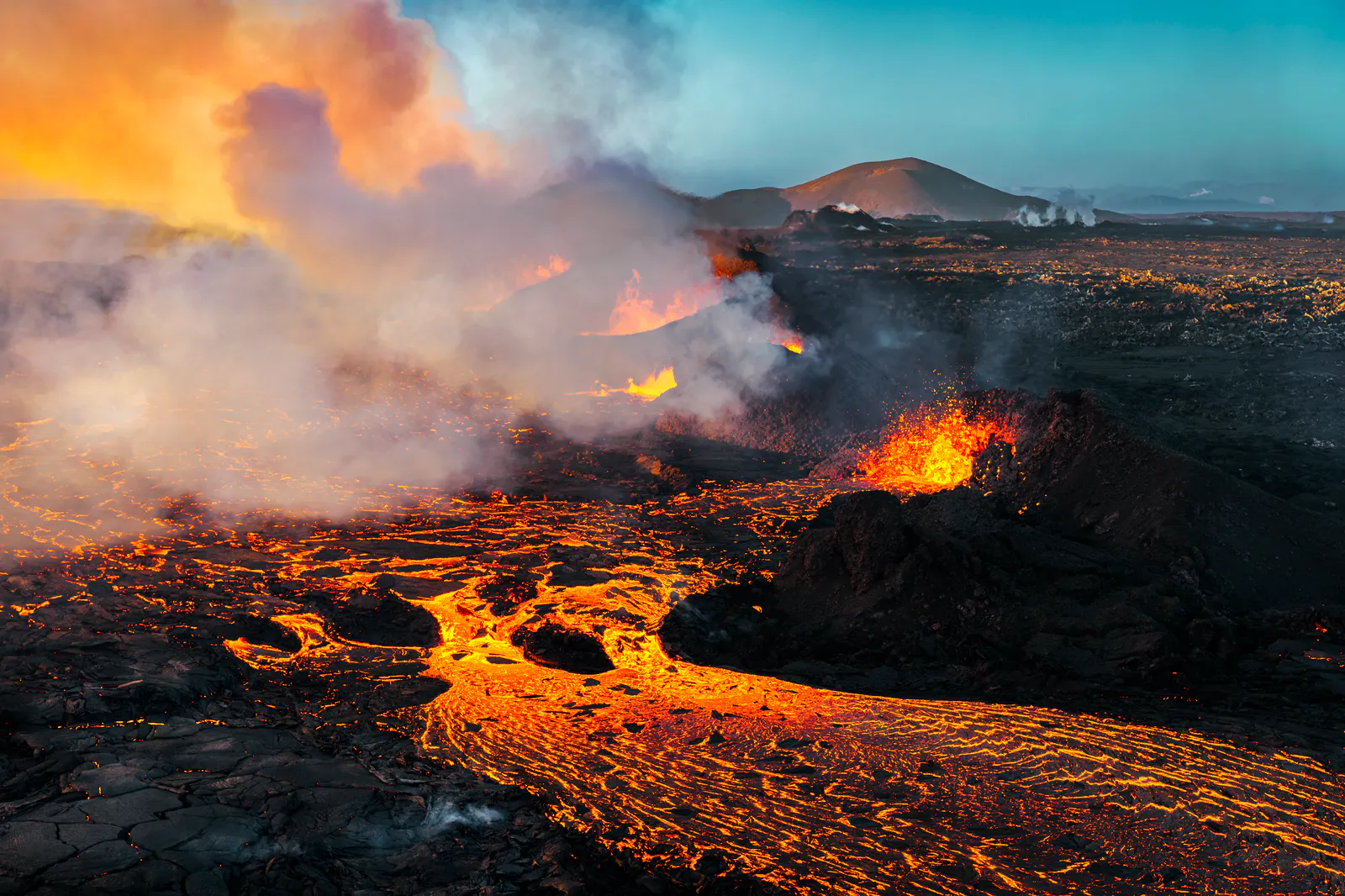
The Central Highlands are built by volcanoes and carved by glaciers.
Volcanic activity is constant beneath the surface. Grímsvötn and Bárðarbunga, both active volcanoes, lie under the massive Vatnajökull ice cap.
That same glacier is the largest in Europe by volume, spanning over 8,100 square kilometers (3,127 sq. miles). Its meltwater feeds powerful rivers that shape the black sand plains below.
When volcanoes erupt beneath glaciers, they melt ice quickly and cause sudden glacial floods called, in Icelandic, jökulhlaups. These floods, like those triggered by Grímsvötn, can reshape entire valleys in a matter of hours.
Geothermal Wonders
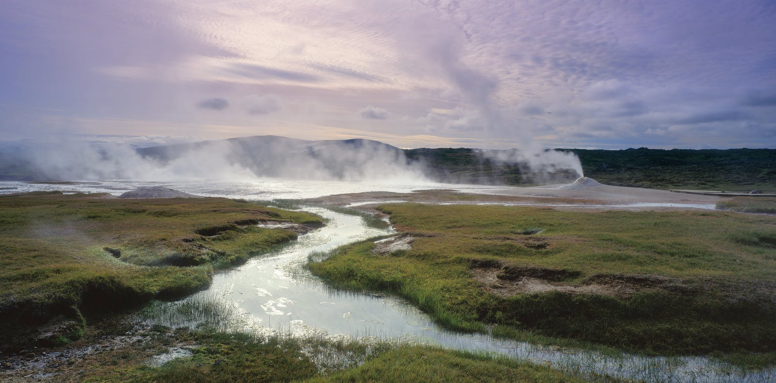
In many places, Iceland’s underground heat reaches the surface.
Geothermal areas like Hveravellir, Hveradalir, and Torfajökull are filled with steaming vents, bubbling mud pools, and colorful mineral deposits. Temperatures at shallow depth below these fields can reach 200°C (392°F).
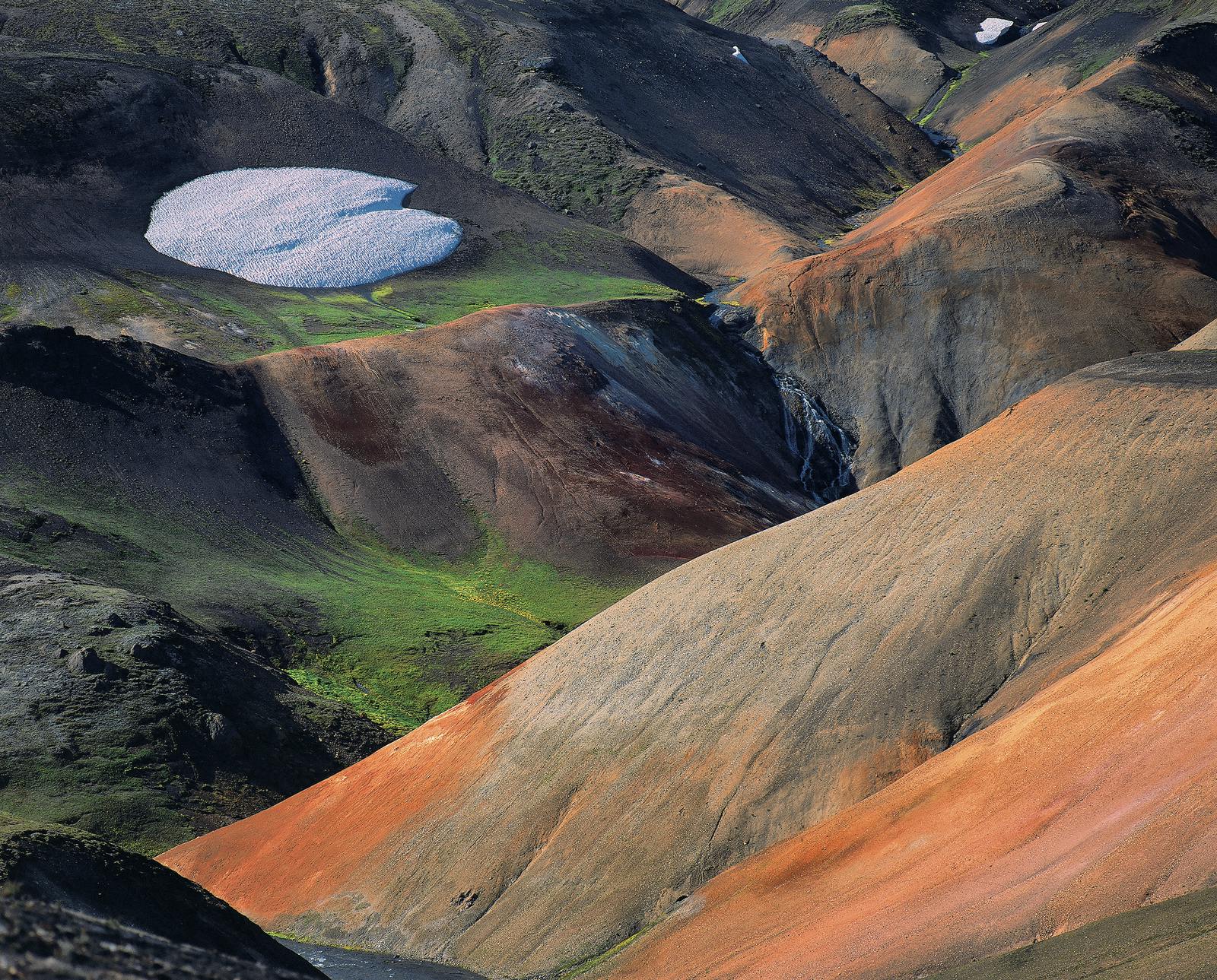
The most famous geothermal area in the Central Highlands might be Landmannalaugar, a natural hot spring oasis surrounded by colorful mountains.
A Living Volcano Museum
The Icelandic highlands are like an open-air geology museum.
You'll find:
- Lava fields from recent eruptions
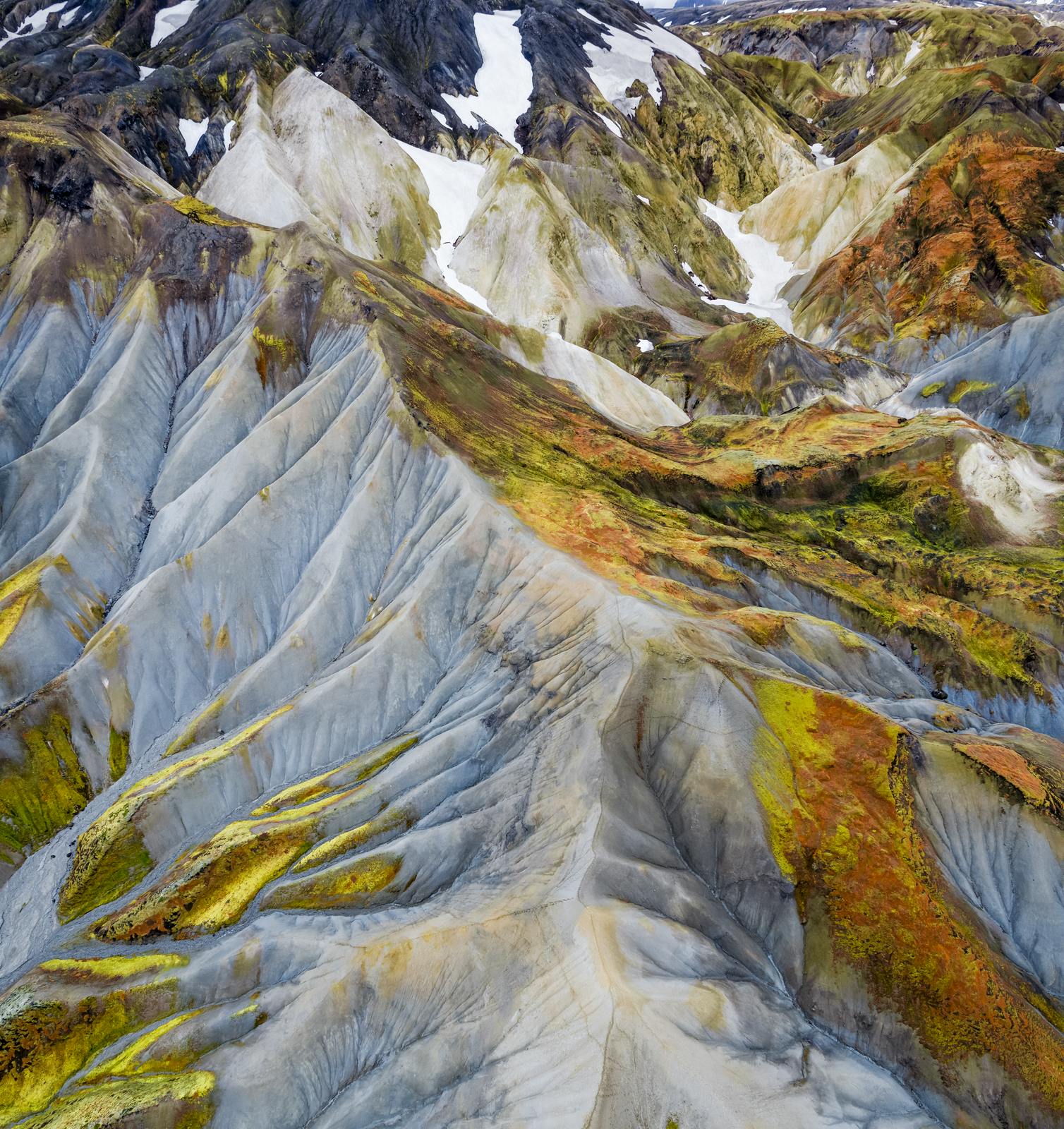
- Rhyolite mountains that change color in the light
- Crater rows like Lakagígar (the Laki craters)
- Volcanic fissures, calderas, and active geothermal zones.
The minerals in rhyolite rocks cause mountain slopes to appear red, yellow, green, and even blue. These colorful landscapes are most famously found in Landmannalaugar and Bláhnúkur.
Highlands You Can Visit
Each part of the highlands has something different to offer. These places show off the diversity of the highlands: from desert plains to green valleys to steaming hot springs. Some top spots include:
- Landmannalaugar – Colorful rhyolite mountains, natural hot springs, and hiking trails
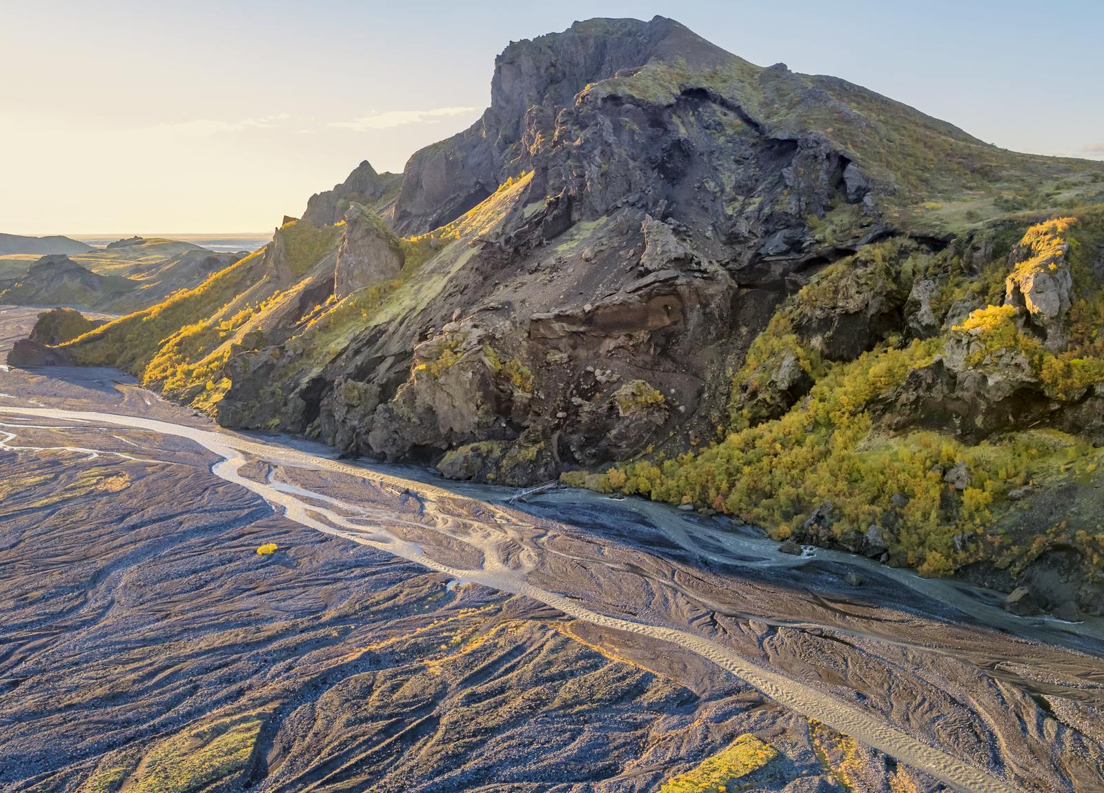
- Þórsmörk – A green valley surrounded by glaciers
- Fimmvörðuháls – A trail between two glaciers with views of lava and waterfalls
- Laki (Lakagígar) – A 25-kilometer row of volcanic craters from a massive 1783 eruption
- Sprengisandur – A highland desert with vast open views
- Hofsjökull & Tungnafellsjökull – Two large central ice caps
- Eldgjá – The world’s largest volcanic canyon.
Nature Always Finds a Way
Despite the tough conditions, life finds a way in the Icelandic Central Highlands. Arctic foxes, Iceland’s only native land mammal, roam the landscape in search of food.
Hardy birds like ptarmigans thrive here, while mosses and lichens cling to even the youngest lava fields.
In more sheltered places like Þórsmörk, dwarf birch and willow take root. These plants and animals are specially adapted to survive the cold, fierce winds, and nutrient-poor volcanic soil.
Short Season, Tough Travel
You can only visit the Central Highlands during summer, from late June to early September.
Outside these months, the roads - called F-roads - are closed due to snow, flooding, and poor visibility.
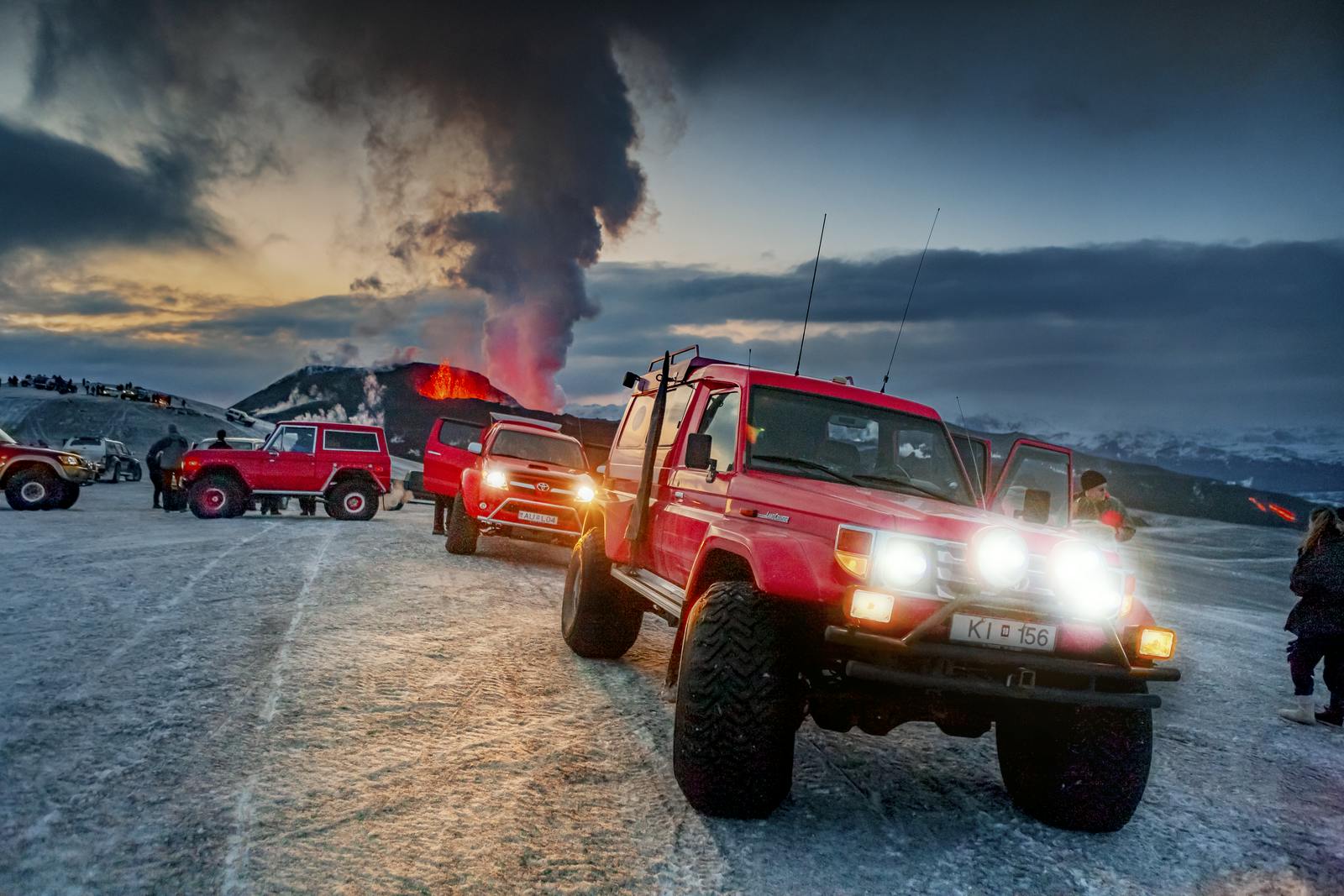
Even in summer, these roads are gravel and rough, often with unbridged rivers. You must use a 4x4 vehicle.
River crossings are part of the journey and can be dangerous. Conditions vary day by day depending on rainfall and glacier melt.
Average rainfall in parts of the highlands can be over 2,000 mm per year, so always check river levels before heading out.
Getting There
Most highland trips start from Reykjavik, Iceland’s capital. Plan for long drives, river crossings, and limited facilities. Bring fuel, food, and layers.
Expect a 3 to 6 hour drive, depending on your route and destination.
Popular entry points include:
- Landmannalaugar (via F208)
- Sprengisandur (F26) – A more remote route between north and south
- Kjölur Route (F35) – A well-traveled, historic trail used since Viking times. It runs about 160 kilometers, cutting through the center of the country from Gullfoss to Blönduós. It’s easier to drive than other highland routes and offers a great introduction to the landscape. You’ll pass hot springs, glaciers, and volcanic plateaus – all in a day’s journey.
Learn More at Perlan
If you are curious about how the Central Highlands were formed, Perlan is a great place to visit. Our Forces of Nature exhibition explains Iceland's volcanoes and glaciers in an interesting and accessible way through video and interactive displays. You will learn about the natural events that shaped the region. You might even find that it will help you connect more deeply with the natural beauty of Iceland, without leaving Reykjavik.
Highland FAQ
Are the Central Highlands in Iceland worth it?
Yes, the highlands offer unique geological formations, including active volcanoes, glaciers, and geothermal areas.
Does anyone live in the Icelandic highlands?
The highlands are largely uninhabited, with only seasonal ranger stations present during the summer months.
When can you visit the Icelandic highlands?
Access is typically from late June to early September, when F-roads are passable. For the latest road conditions, visit https://www.vegagerdin.is/en/travel-info/mountain-roads, which is updated throughout the day.
What is the best highland route in Iceland?
The Kjölur route (F35) is a popular historic track, offering a classic highland experience. It traverses northward across the highlands from Gullfoss on the Golden Circle to Blönduós.
What to do in the Icelandic highlands?
Hiking, exploring geothermal areas, and 4x4 driving are popular activities.
What is the climate like in the highlands of Iceland?
The climate is subarctic, with short, cool summers and long, cold winters, and high wind speeds.
What is the average elevation of the Iceland highlands?
The average elevation is around 800 meters above sea level.
Popular articles
Let's Talk About the Volcano in Iceland About to Erupt
Is a volcano in Iceland about to erupt? Here’s what travelers should know about Svartsengi, Reykjanes activity, flights, safety, and the Blue Lagoon.
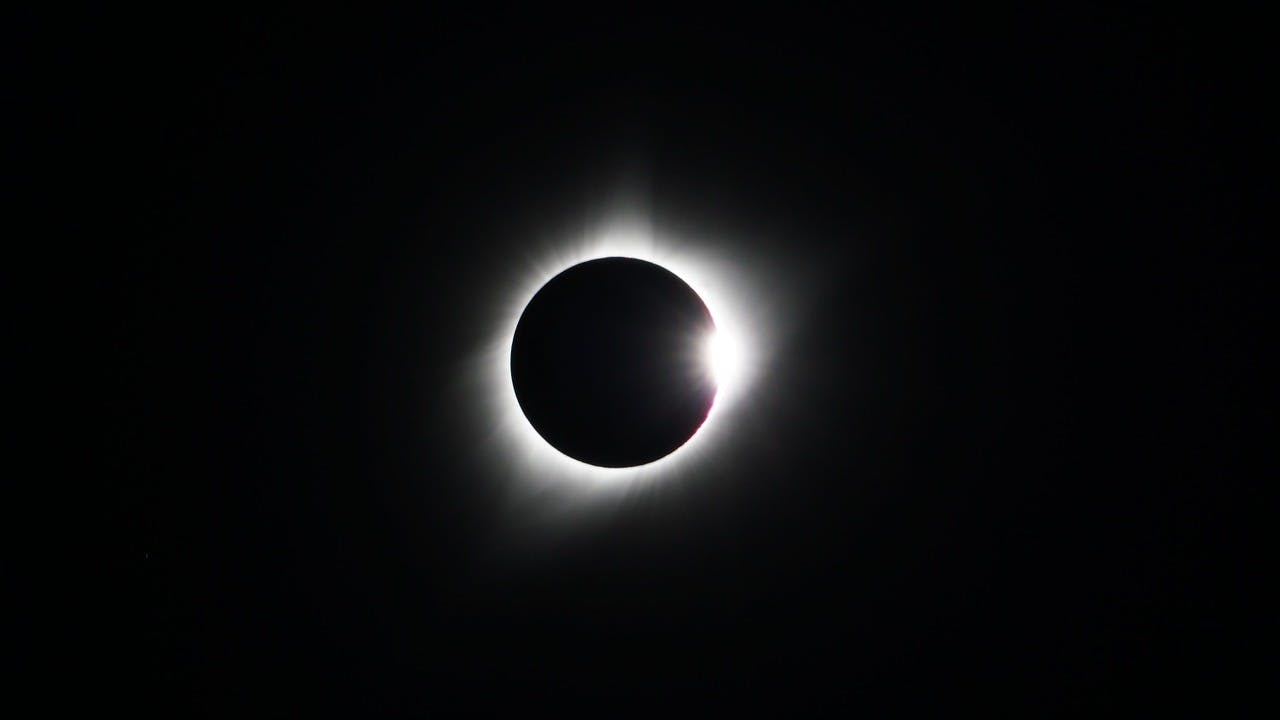
Guide to the Solar Eclipse 2026
Plan your trip to witness the Solar Eclipse 2026 in Iceland! Discover the best viewing spots, key times, safety tips, and travel advice for this rare celestial event.

July 2026 updates on the Sundhnúkagígar Eruption in the Reykjanes Peninsula!
The current eruption in the Reykjanes Peninsula, is called Sundhnúkagígar Crater Row. See insights on the seismic activity and volcanic eruptions in the area!
Active Volcanoes in Iceland 2026
Active volcanoes aren't the same thing as active eruptions. A volcano can be considered active even when it is not ejecting ash, rock, gases and magma, so which are active in Iceland in 2026?

Top 10 Places To See the Northern Lights in Iceland
You can see the northern lights across the country, but some spots are more suitable than others. Find the best place to see the northern lights in Iceland.

Ice Caves From Reykjavik
Travel beyond the capital for a closer look at an ice cave under one of Iceland’s glaciers. If you can’t spare the time, experience Perlan’s ice cave in Reykjavik.