
Fimmvörðuháls Is Iceland’s Most Dramatic Day Hike
Walking the Fimmvörðuháls trail means crossing a volcanic ridge between two large glaciers, Eyjafjallajökull and Mýrdalsjökull. You’ll see volcanic craters, new lava fields, and waterfalls as you hike through wild Icelandic terrain.
A Startling Highland Story
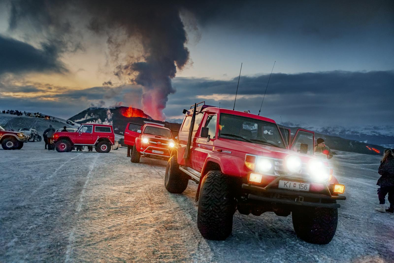
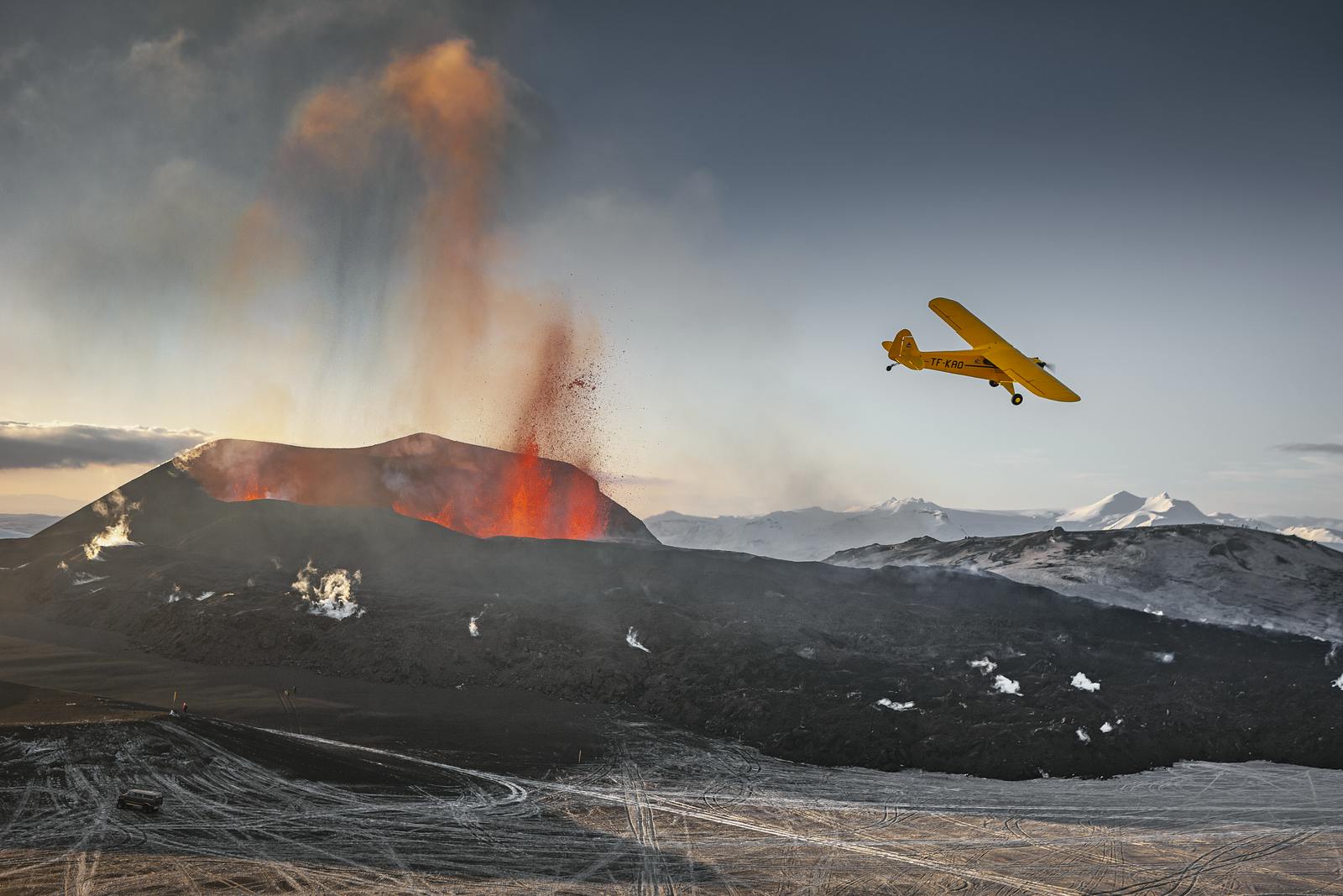
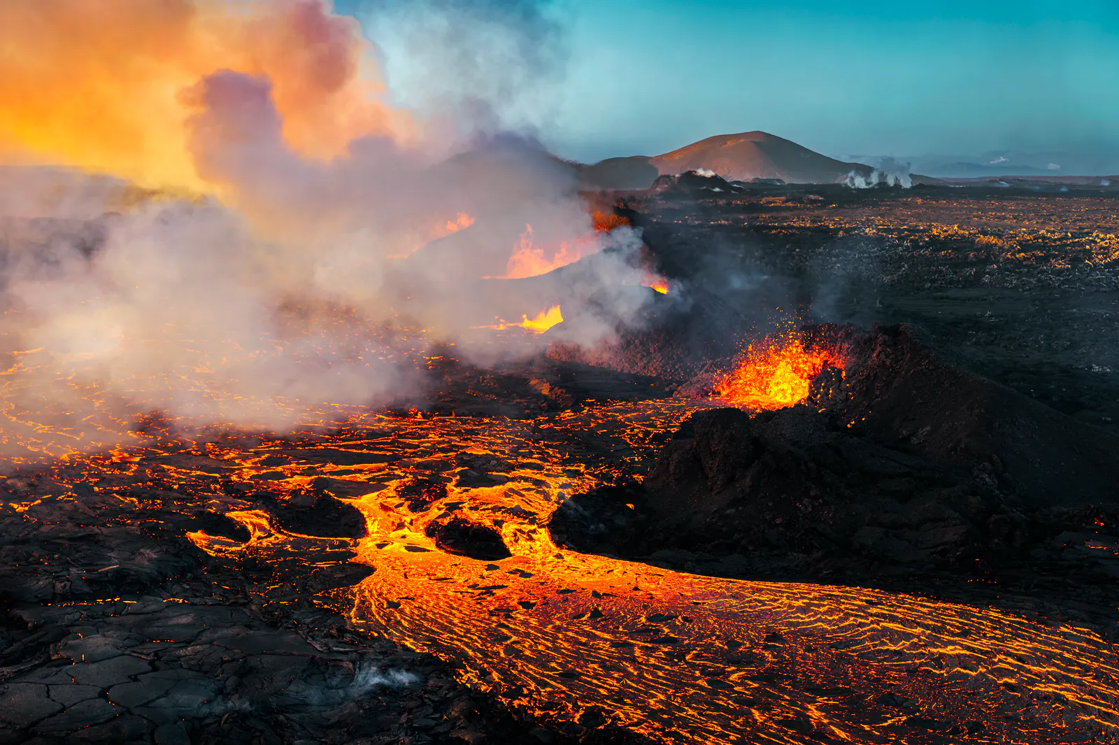
On March 20, 2010, fissures opened between Eyjafjallajökull and Mýrdalsjökull. Lava flowed to the surface, creating craters named Magni and Móði — sons of the Norse god Thor. These craters and fresh lava fields are visible today along the Fimmvörðuháls pass. This dramatic event transformed the trail and drew hikers worldwide. This rather small eruption was a forerunner of the powerful Eyjafjallajökull eruption that started immediately afterwards.
Overview of the Hike
Fimmvörðuháls means “five-cairn pass” and spans roughly 24–26 km (15–16 mi). The trail climbs about 1,000 m and connects Skógar on the south coast to Thórsmörk valley. Hikers commonly complete it in one long day or split it with overnight stays in mountain huts.
Getting There: Starting at Skógar
The trail begins at Skógar, near the iconic Skógafoss waterfall. Park your car in the village or take a bus. From Skógar, the path follows the Skógá river, passing over 26 waterfalls. This waterfall section is scenic and inspires many hikers early in the day.
Crossing the Lava and Snowfields
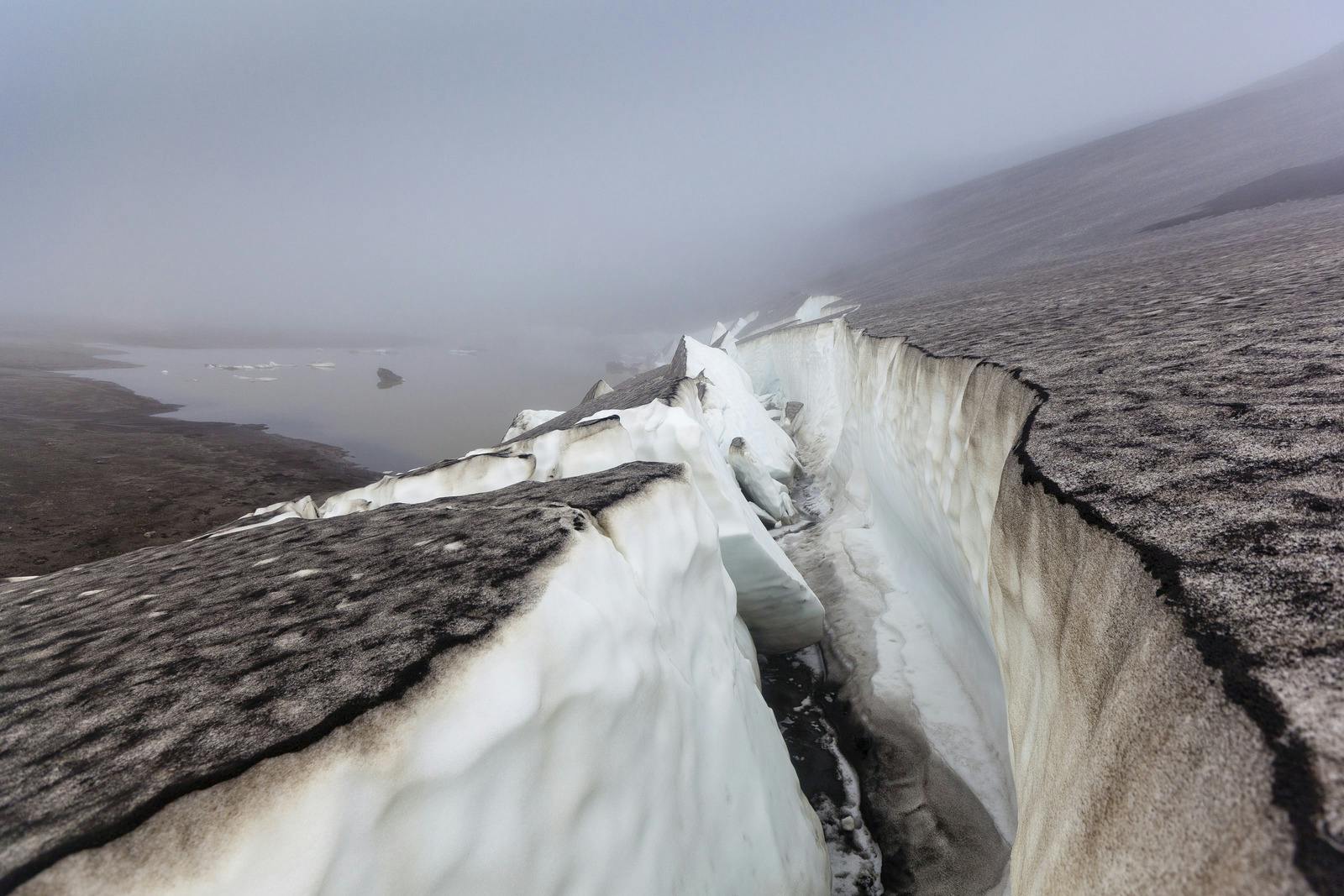
As you ascend, the landscape changes quickly. You’ll walk across a young lava field formed in 2010. The rough black lava contrasts with green moss and bright snow remains on the plateau. Watch for river crossings and sections with loose rock and snow.
Reaching the Mountain Huts
About halfway along the route lies Baldvinsskáli hut, operated by Útivist. It offers a rest stop or overnight option. The huts along the trail, like Básar in Thórsmörk, are spaced 12–16 km (7–10 mi) apart. Staying overnight gives time to explore the craters and summit at leisure.
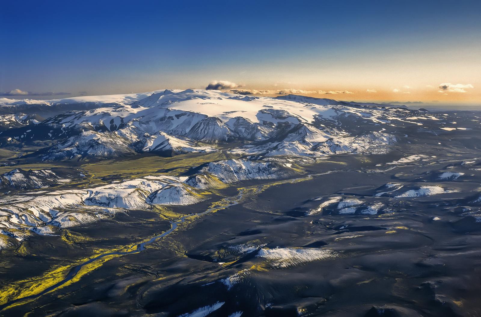
Hiking Between Two Glaciers
From Baldvinsskáli, the trail climbs to the top of the pass. You walk between the ice fronts of Eyjafjallajökull and Mýrdalsjökull. This ridge is the highest point on the trail and offers dramatic views. Clouds may gather quickly because of the glaciers, so prepare for bad weather.
Exploring the Volcanic Craters
Just after reaching the pass, you find the new craters of Magni and Móði, created in 2010. Inspect their jagged rims and small lava flows. The erupted lava streamed downhill and formed the new Goðahraun lava field in Þórsmörk valley.
Descending into Þórsmörk via the Cat’s Spine Ridge
The trail drops into Þórsmörk along the Cat’s Spine ridge — a rocky, narrow path with steep drops. This descent provides stunning views back toward the glaciers and lava fields. You eventually reach the lush green valleys of Þórsmörk, a dramatic change from the earlier volcanic terrain.
Nature Highlights
Waterfalls
Skógafoss is one of the largest and most famous waterfalls in Iceland. Over 26 smaller waterfalls follow the river as you hike the Fimmvörðuháls pass.
Glacial Landscapes
Eyjafjallajökull and Mýrdalsjökull glaciers flank the trail. Their presence affects the weather, sometimes causing fog, snow, or rain without warning.
Volcanic Zones
The Goðahraun lava from 2010 still glows alongside the trail. You walk among newly formed craters, and the rugged landscape shows nature’s raw power.
Highland Flora and Fauna
Surprisingly, hardy grasses, moss, alpine flowers, and lichens grow in sheltered zones. Birds such as snow buntings and golden plovers nest in tundra areas during summer.
Logistical Tips
- Distance & Elevation: ~24–26 km (15–16 miles) with 1,000 m (3,280 ft) ascent
- Best months: mid-June to early September
- Access: A 4×4 vehicle is necessary at Skógar or Þórsmörk
- Transport: Buy a bus or shuttle ticket, one way, if not arranging car transfers
- Huts and camping: Baldvinsskáli and Básar offer basic lodging; no permits are needed for camping.
Preparing for the Trail
- Wear sturdy hiking shoes
- Use hiking poles for rocky and icy terrain
- Carry layers and waterproof clothing
- Pack water, snacks, and sun protection
Stay on marked trails:the environment is fragile near glaciers and lava - Monitor weather alerts, especially for glacier winds and snowstorms
Combining with Laugavegur
Many hikers add Fimmvörðuháls to the Laugavegur trail, creating an 80-mile (50 km) trek. This full journey takes 4–6 days, crossing diverse terrain and highland ecosystems.
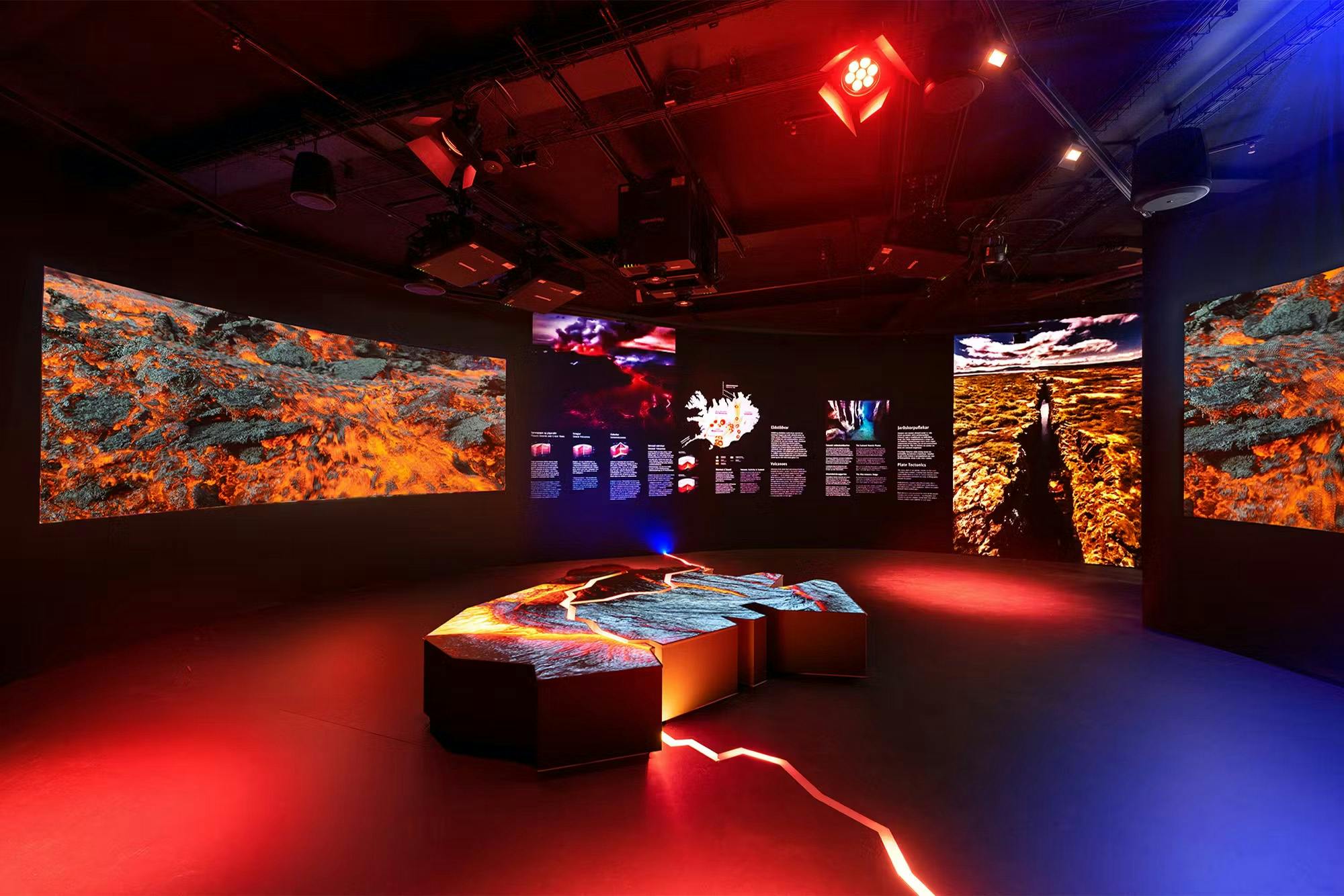
Learn More at Perlan
To understand the volcanic and glacial forces that forged Fimmvörðuháls, visit the Perlan Museum in Reykjavík. It offers educational, interactive displays on volcanoes, earthquakes, glaciers, and highland geology for visitors of all ages.
Frequently Asked Questions
How far is the Fimmvörðuháls hike?
About 24–26 km (15–16 miles). It involves roughly 1,000 m (3,280 ft) of climbing.
How long does it take?
Most hikers take 8–12 hours, or split it over two days with an overnight stay.
Can I park my car?
Yes, but you need either a 4×4 or to join a transfer service.
Are there huts on the trail?
Yes. Two huts, Baldvinsskáli mid-pass and Básar in Þórsmörk, offer beds and shelter.
What wildlife will I see?
Look for snow buntings, golden plovers, and alpine flowers in summer.
Can the hike turn dangerous in bad weather?
Yes. Winds and sudden snow near the glaciers can make sections risky. Check conditions before starting.
Is this hike better south-to-north?
Many recommend the Skógar to Þórsmörk direction. Waterfalls appear early, and the sun is often at your back.
Popular articles
Let's Talk About the Volcano in Iceland About to Erupt
Is a volcano in Iceland about to erupt? Here’s what travelers should know about Svartsengi, Reykjanes activity, flights, safety, and the Blue Lagoon.
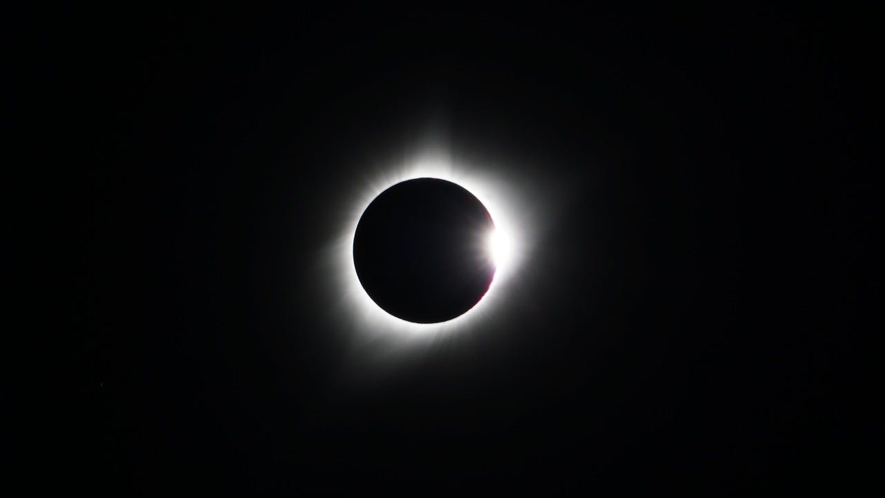
Guide to the Solar Eclipse 2026
Plan your trip to witness the Solar Eclipse 2026 in Iceland! Discover the best viewing spots, key times, safety tips, and travel advice for this rare celestial event.

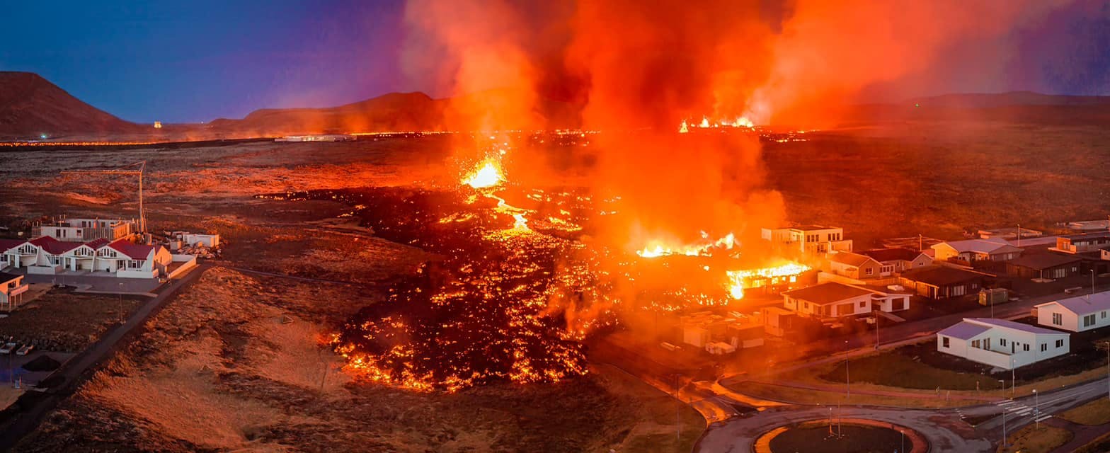
July 2026 updates on the Sundhnúkagígar Eruption in the Reykjanes Peninsula!
The current eruption in the Reykjanes Peninsula, is called Sundhnúkagígar Crater Row. See insights on the seismic activity and volcanic eruptions in the area!
Active Volcanoes in Iceland 2026
Active volcanoes aren't the same thing as active eruptions. A volcano can be considered active even when it is not ejecting ash, rock, gases and magma, so which are active in Iceland in 2026?

Top 10 Places To See the Northern Lights in Iceland
You can see the northern lights across the country, but some spots are more suitable than others. Find the best place to see the northern lights in Iceland.

Ice Caves From Reykjavik
Travel beyond the capital for a closer look at an ice cave under one of Iceland’s glaciers. If you can’t spare the time, experience Perlan’s ice cave in Reykjavik.