
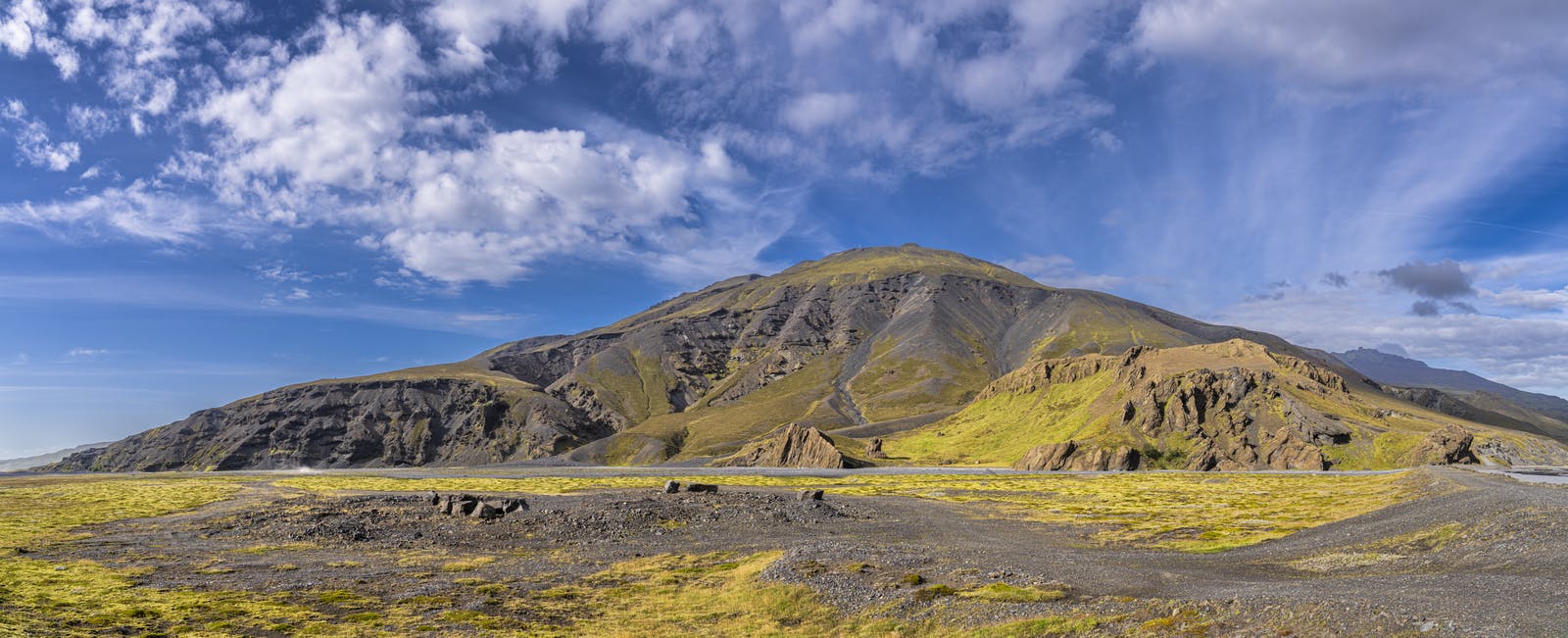
Þórólfsfell Iceland
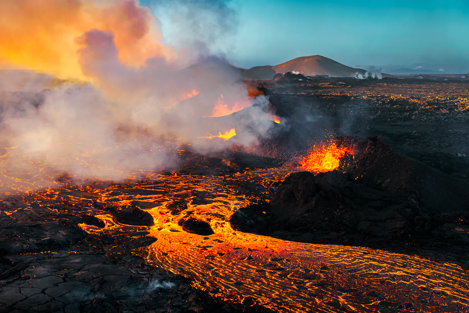
Þórólfsfell is a lesser-known volcanic hill located in the southern highlands of Iceland. It sits quietly between two major forces, Mount Hekla to the north and the Markarfljót River to the south. While it doesn’t erupt like its neighbour, Þórólfsfell is still shaped by Iceland's powerful volcanic past. It was formed in a subglacial eruption during the Ice Age.
The eruption started below the ice, forming a steep-sided hill made of hyaloclastite and basaltic breccia. Finally, the eruption had created a mountain high enough to rise above the ice. Then the eruption changed, and basaltic lava capped the mountain top. This type of volcano is called a tuya. Þórólfsfell is a tuya.
At just under 600 metres in elevation, it's not tall by Icelandic standards. But it stands out against the surrounding plains and valleys. Its slopes are covered in loose rock and moss, and from the top, you can enjoy panoramic views of nearby glaciers such as Mýrdalsjökull, Eyjafjallajökull and Tindfjallajökull, Markarfljót River, and volcanic landscapes. It’s a peaceful place, far from the typical tourist routes.
What is a Tuya?
A tuya is a flat-topped, steep-sided volcano that forms when lava erupts through a thick glacier or ice sheet. The lava cools very quickly because of the ice, which causes it to pile up instead of flowing farther. This creates a tall, stubby shape that looks a bit like a table or a butte. Tuyas are unique to places that have both volcanic activity and large amounts of ice, like Iceland or Antarctica. They are interesting to scientists because they show where glaciers and volcanoes existed at the same time in the past.
Where Exactly Is Þórólfsfell?
You’ll find Þórólfsfell in the southern part of Iceland’s highlands, not far from Route 26. It lies roughly 120 kilometres from Reykjavík and around 20 kilometres south of Hekla, one of Iceland's most active volcanoes.
The drive takes about 2.5 to 3 hours, depending on weather and road conditions. Parts of the route may require a 4x4 vehicle, especially in summer when the highland roads (known as F-roads) open. During winter, these roads are often closed due to snow or flooding. Because Þórólfsfell isn’t widely advertised, it tends to attract hikers and geology lovers looking for quieter experiences.
What Makes Þórólfsfell Worth Visiting?
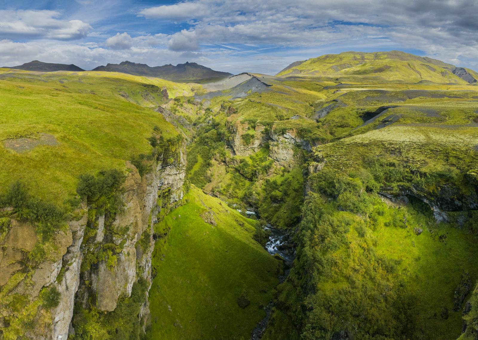
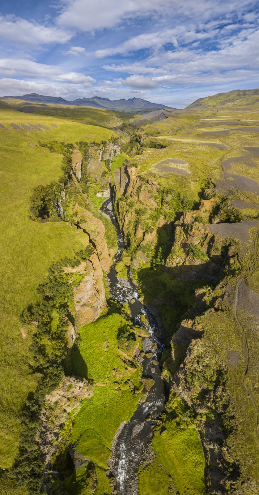
Though it’s small, Þórólfsfell offers a great deal to those who take the time to explore it. Its location provides a unique blend of geological features. You’ll find traces of old lava flows, tephra layers, and sediment shaped by nearby eruptions.
The hill itself provides an excellent vantage point. On clear days, you can see the Mýrdalsjökull glacier to the south and Hekla’s cone to the north. In between lies a sea of lava fields, ash plains, and winding rivers.
It’s also an excellent place for quiet hiking. The trails aren’t marked, but experienced hikers can follow visible paths to the summit. The ground can be loose and rocky, so proper shoes are essential. Þórsmörk, a nearby valley in the southern highlands, is also a great place to visit for those exploring the volcanic landscapes around Þórólfsfell.
What to Expect at Þórólfsfell
The hill has no facilities, signs, or marked trails. It's part of what makes it special. There’s nothing between you and the landscape, just wind, rock, and sky.
Most visitors come to hike or take photos. The climb to the top takes about 30 to 45 minutes, depending on your pace and fitness. While not difficult, the terrain can be uneven. Watch your footing and take your time.
Safety Tips for Visiting
Þórólfsfell may look calm, but it sits in a dynamic part of the country. Both volcanic activity and rapid weather changes shape this region. Here are some basic precautions to keep in mind:
- Always check the weather before heading out. Storms can come quickly, especially in the highlands.
- Bring layers, even in summer. Temperatures can change fast.
- Wear hiking boots or strong shoes with a good grip.
- Bring enough food and water for your trip.
- Let someone know where you’re going if you plan to hike alone.
- Watch for loose rocks, especially on the slopes.
Also, while Hekla is nearby, it’s still active. Though there's no immediate threat, it’s good to stay updated on volcanic alerts before you travel to the area.
Learn More at Perlan
Before heading out into the wild highlands, it’s a smart idea to stop by Perlan in Reykjavík. Perlan is one of Iceland’s most informative visitor attractions and features a whole exhibit dedicated to volcanoes.
Here, you can learn about how Iceland’s landscapes were formed, how volcanoes like Hekla work, and what causes lava flows and ash clouds. The interactive displays explain how Þórólfsfell fits into the larger story of Iceland’s geology.
Perlan even has a real ice cave and a 360° viewing deck, giving you a taste of Iceland’s extremes without leaving the city. It’s the perfect place to start your journey if you're curious about what lies beneath the ground.
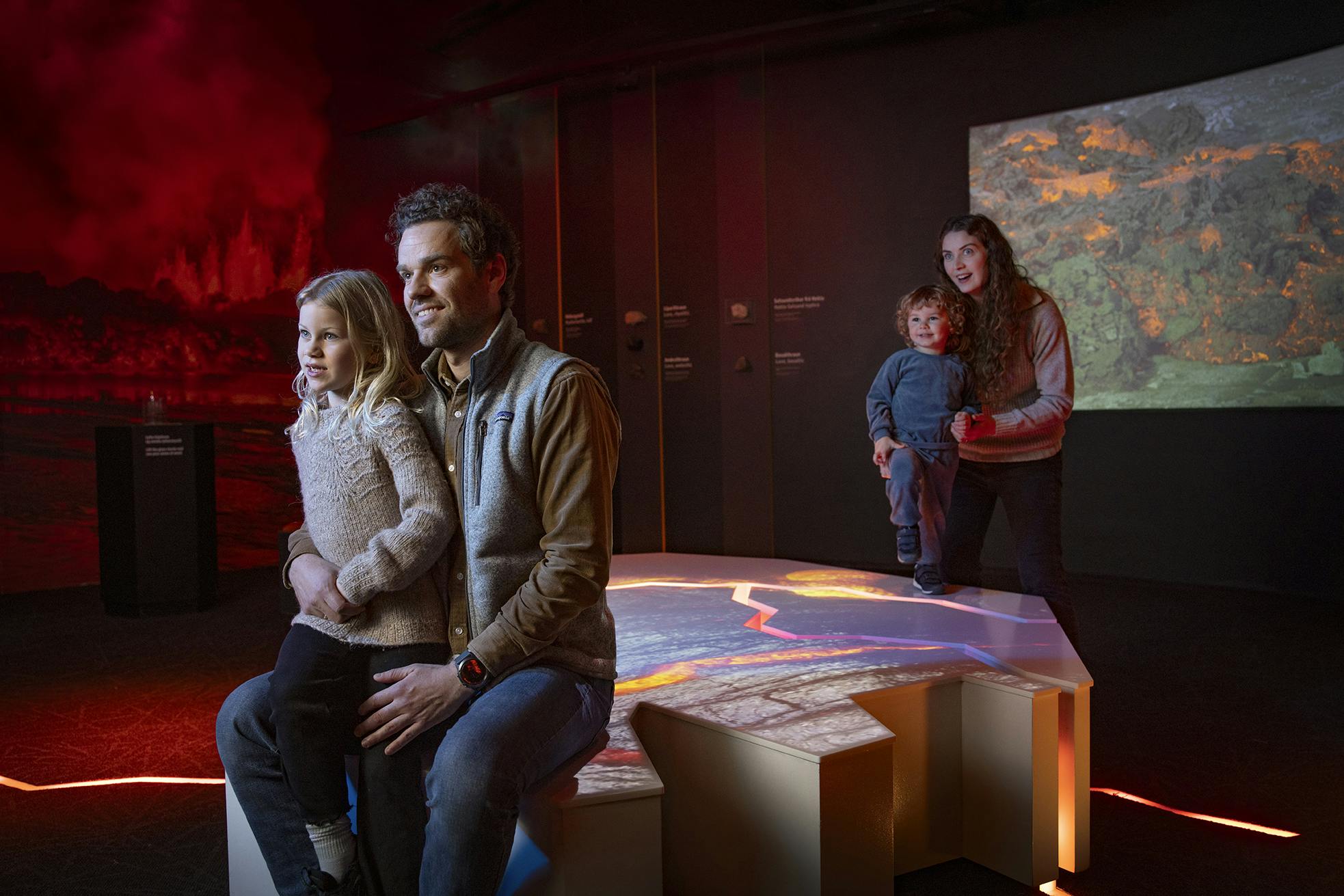
The Forces of Nature exhibition at Perlan explains how volcanic eruptions, earthquakes, and geothermal energy continue to shape Iceland’s landscapes.
FAQ
How long does the hike take?
Around 30 to 45 minutes each way, depending on conditions and your pace.
Is the road to Þórólfsfell open year-round?
No. It’s usually open in summer but often closed in winter due to snow or flooding.
Is it safe to visit?
Yes, with proper planning. Always check the weather and road conditions before you go.
Are there any facilities nearby?
No. There are no restrooms, shops, or emergency services at Þórólfsfell.
Do I need a 4x4 to reach it?
In most cases, yes. The roads are gravel and can be rough in places.
Why visit Perlan before going?
Perlan gives you a clear understanding of Iceland’s volcanic systems, which enhances the experience of places like Þórólfsfell.
Popular articles
Let's Talk About the Volcano in Iceland About to Erupt
Is a volcano in Iceland about to erupt? Here’s what travelers should know about Svartsengi, Reykjanes activity, flights, safety, and the Blue Lagoon.
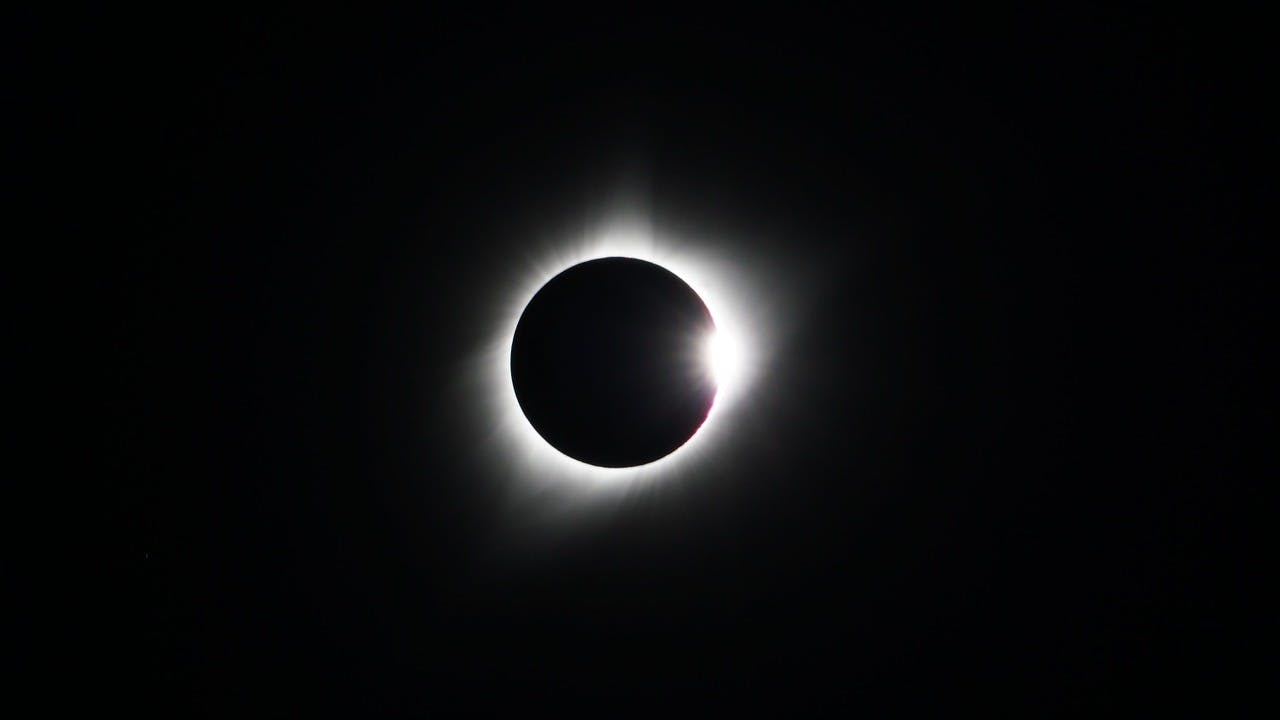
Guide to the Solar Eclipse 2026
Plan your trip to witness the Solar Eclipse 2026 in Iceland! Discover the best viewing spots, key times, safety tips, and travel advice for this rare celestial event.

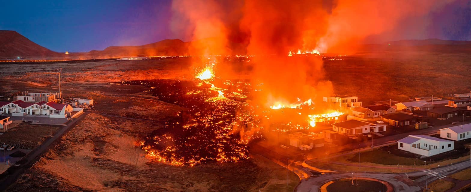
July 2026 updates on the Sundhnúkagígar Eruption in the Reykjanes Peninsula!
The current eruption in the Reykjanes Peninsula, is called Sundhnúkagígar Crater Row. See insights on the seismic activity and volcanic eruptions in the area!
Active Volcanoes in Iceland 2026
Active volcanoes aren't the same thing as active eruptions. A volcano can be considered active even when it is not ejecting ash, rock, gases and magma, so which are active in Iceland in 2026?

Top 10 Places To See the Northern Lights in Iceland
You can see the northern lights across the country, but some spots are more suitable than others. Find the best place to see the northern lights in Iceland.

Ice Caves From Reykjavik
Travel beyond the capital for a closer look at an ice cave under one of Iceland’s glaciers. If you can’t spare the time, experience Perlan’s ice cave in Reykjavik.