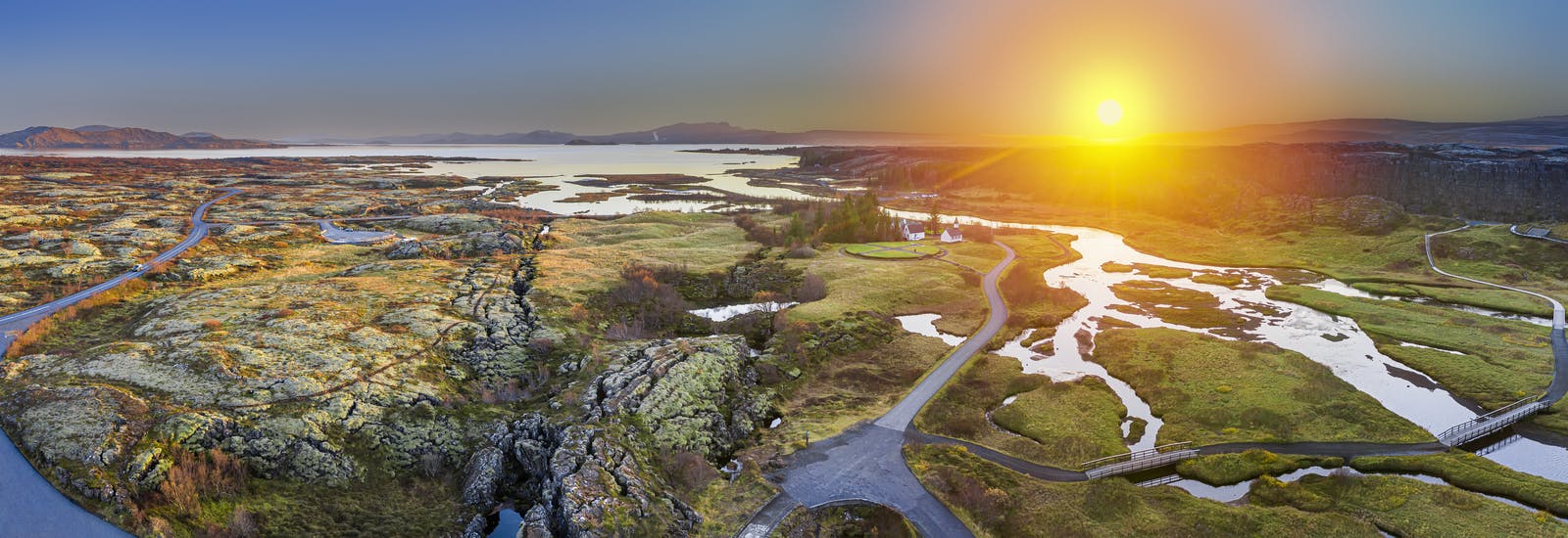
Discover Þingvellir National Park in Iceland
Nestled in the heart of Iceland, Þingvellir (pronounced Thing-vet-lir) stands as a testament to the intertwined narratives of nature and history. This unique site, located on the boundary between the North American and Eurasian tectonic plates, is more than just a picturesque landscape; it is a place of great geological significance and historical importance. Þingvellir is a UNESCO World Heritage Site and is situated approximately 40 kilometres east of Reykjavík.
Þingvellir is situated within the Mid-Atlantic Ridge, a vast submarine mountain range where the North American and Eurasian tectonic plates meet. It comes to the shore of Reykjanes and crosses the Þingvellir area and all of Iceland The site is an open-air showcase of the geological forces that shape the Earth. Visitors can witness the dramatic evidence of plate tectonics through the Almannagjá fissure, a visible crack in the Earth's crust that runs through the Þingvellir National Park.
Silfra Rift
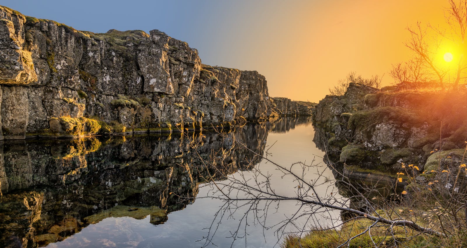
One of the most captivating features of Þingvellir is the Silfra Rift, a freshwater fissure located in the heart of the national park. This unique rift provides an opportunity to snorkel or dive in the crystal-clear waters that separate the North American and Eurasian plates. The water in Silfra is renowned for its purity, having undergone natural filtration through porous underground lava rock for decades. The experience of swimming between two continents, with visibility often exceeding 100 metres, is a surreal encounter with the Earth's geological processes.
Almannagjá
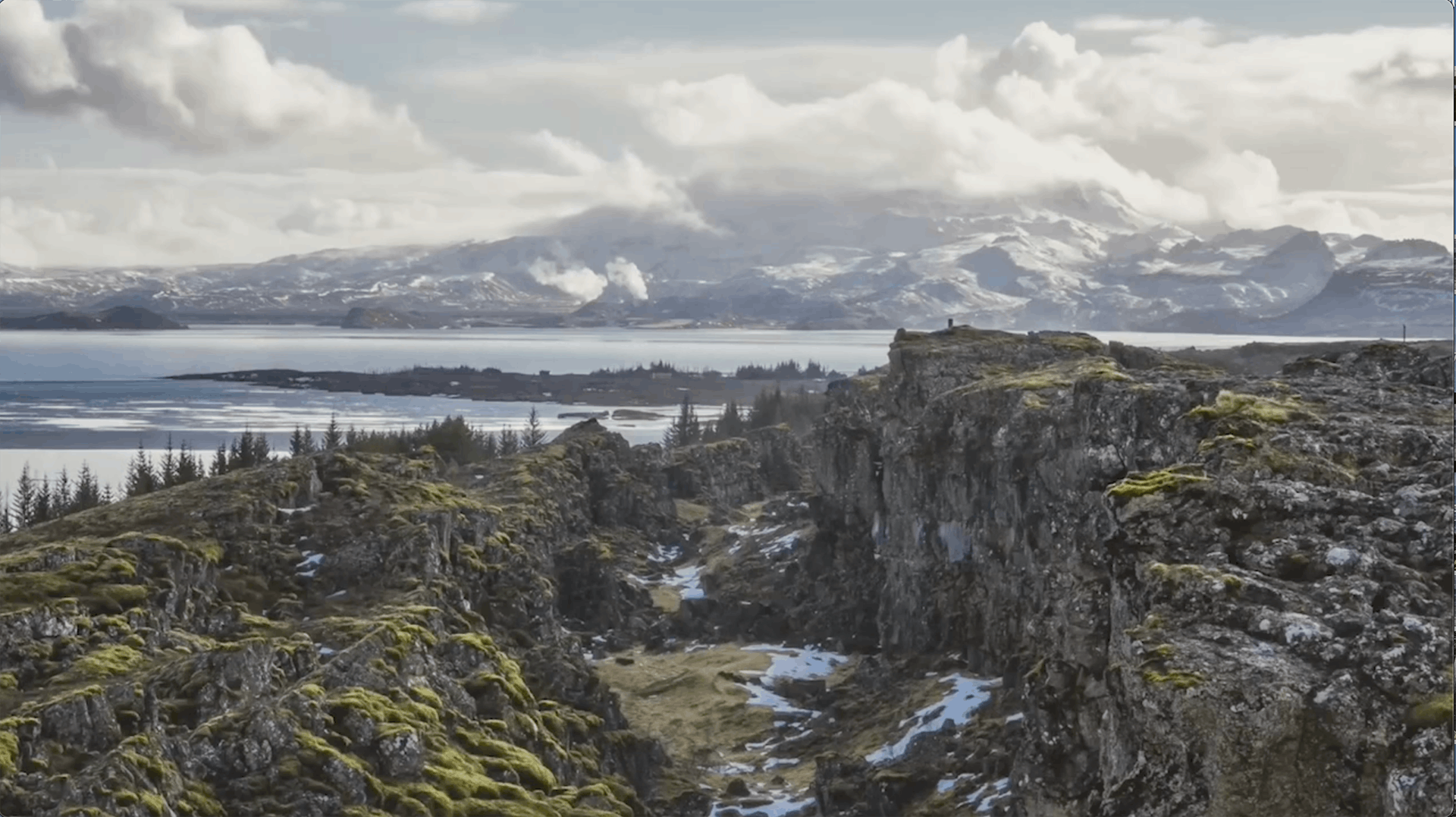
Almannagjá is more than just a geological cleft; it's a tangible expression of the dynamic forces shaping the Earth. This location makes it a part of a divergent boundary, where the plates are gradually moving away from each other. The visible crack in the Earth's crust at Almannagjá is a testament to the relentless forces beneath the surface, where magma rises to create new crust and widen the gap between the plates.
What sets Almannagjá apart is its accessibility and the opportunity it provides for visitors to walk between two continents. As one stands within the fissure, there's a tangible sense of being in a geological no-man's-land, straddling the boundary of North America and Eurasia. The significance of this experience is underscored by the realisation that the Earth's crust is, quite literally, beneath one's feet.
Tectonic Plates
A tectonic plate is a massive, rigid slab of solid rock that forms part of the Earth's lithosphere—the outermost layer of the Earth. The lithosphere is divided into several large and small pieces called tectonic plates, and these plates are in constant motion on the Earth's surface. The movement of tectonic plates is a fundamental geological process responsible for shaping the Earth's surface features and driving various geological activities.
The Earth's lithosphere is divided into several major tectonic plates, each named after the continents or regions they predominantly cover. The boundaries between these plates are known as plate boundaries, and they are the sites where many geological phenomena occur, such as earthquakes, volcanic eruptions, and the creation of mountain ranges.
Natural Wonders
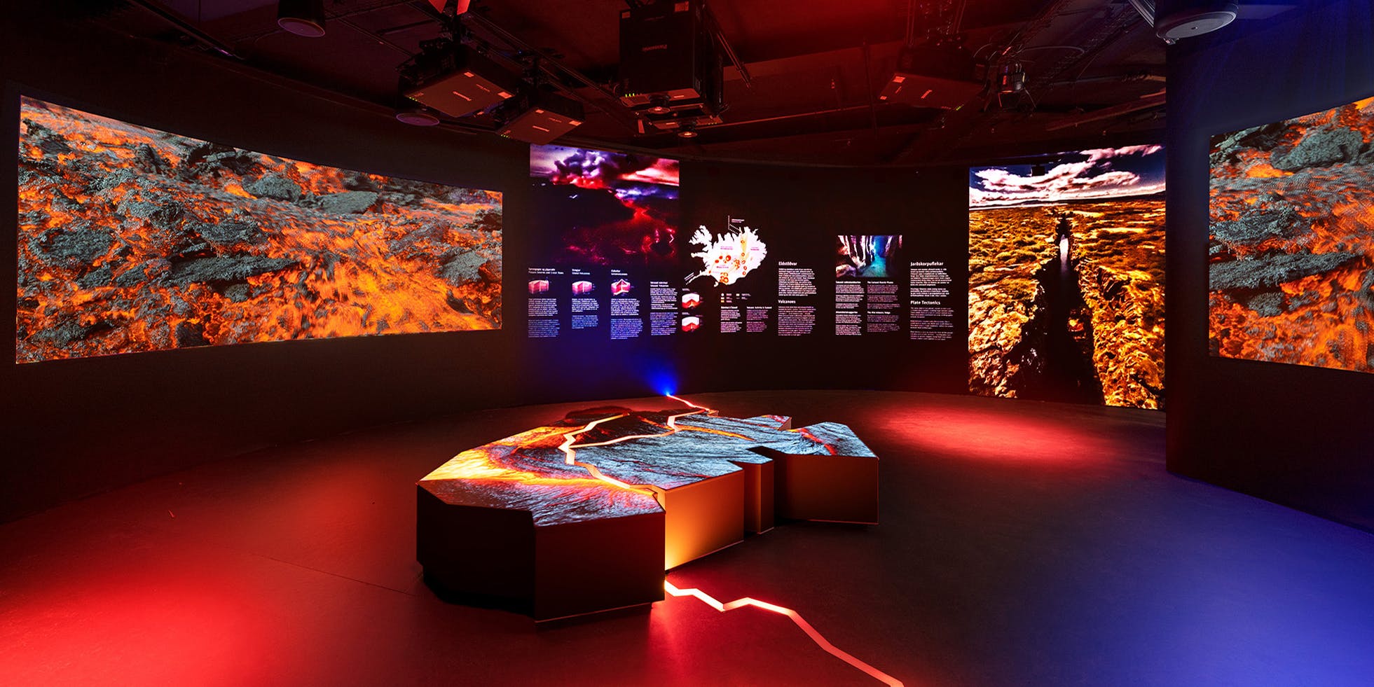
Tectonic Plates, earthquakes and volcanic activity can be very complex to comprehend. At Perlan Museum in Reykjavík, you can learn more about these natural wonders through interactive and exciting exhibitions. In the Forces of Nature exhibition, guests experience the power of volcanoes, earthquakes, and geothermal energy.
Tectonic Plates in Iceland
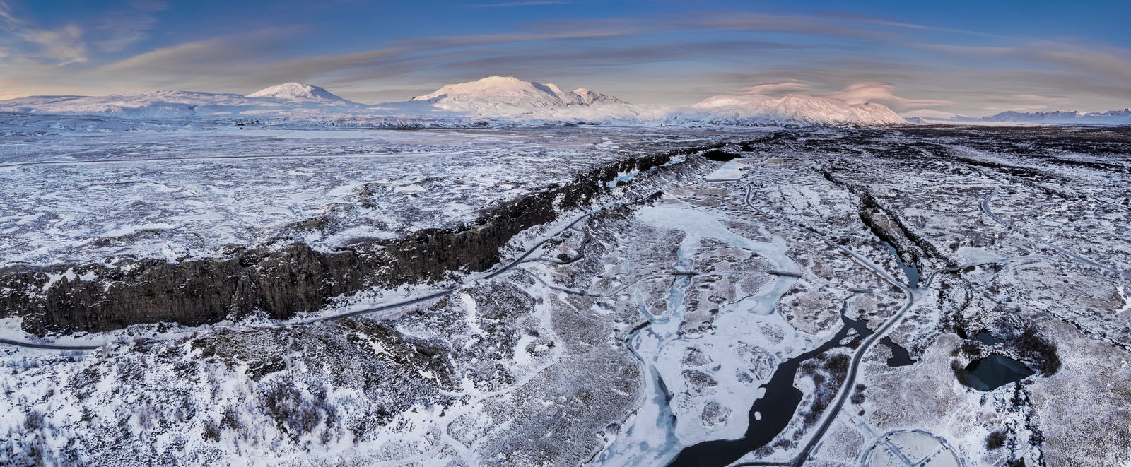
Iceland is a geologically dynamic region situated on the Mid-Atlantic Ridge, making it a prime example of the impact of tectonic activity on the Earth's surface. The country is positioned right on the boundary between the North American and Eurasian tectonic plates, contributing to its unique geological features and geological events. Here are key aspects related to tectonic plates in Iceland:
Mid-Atlantic Ridge
Iceland is part of the Mid-Atlantic Ridge, an underwater mountain range that extends through the Atlantic Ocean. The ridge marks the boundary between the North American and Eurasian tectonic plates.
The Mid-Atlantic Ridge is notable for being a divergent boundary where the plates are moving away from each other. This movement allows magma from the mantle to rise and create new crust, leading to the formation of volcanic activity.
North American and Eurasian Plates
The North American Plate covers the western part of Iceland, while the Eurasian Plate covers the eastern part.
The movement of these plates is responsible for the geologically active features observed in Iceland, such as volcanoes, geysers, and hot springs.
Rifting and Divergence
The divergent movement of the North American and Eurasian plates is evident in Iceland's landscape. The country is experiencing rifting, where the plates are pulling away from each other 1.8 cm/year.
This rifting is particularly pronounced at the Thingvellir National Park, where the Almannagjá fissure showcases the visible gap between the North American and Eurasian plates.
Volcanic Activity
Iceland is renowned for its high level of volcanic activity, which is a direct result of the tectonic processes occurring beneath its surface.
Volcanic eruptions in Iceland have shaped the landscape over the centuries, creating vast lava fields, mountains, stratovolcanoes, crater rows and many other unique geological formations.
Earthquakes
Iceland experiences frequent earthquakes due to the movement of tectonic plates. While many earthquakes are small and go unnoticed, larger seismic events can have significant impacts on the whole infrastructure as well as the landscape.
Historical Significance
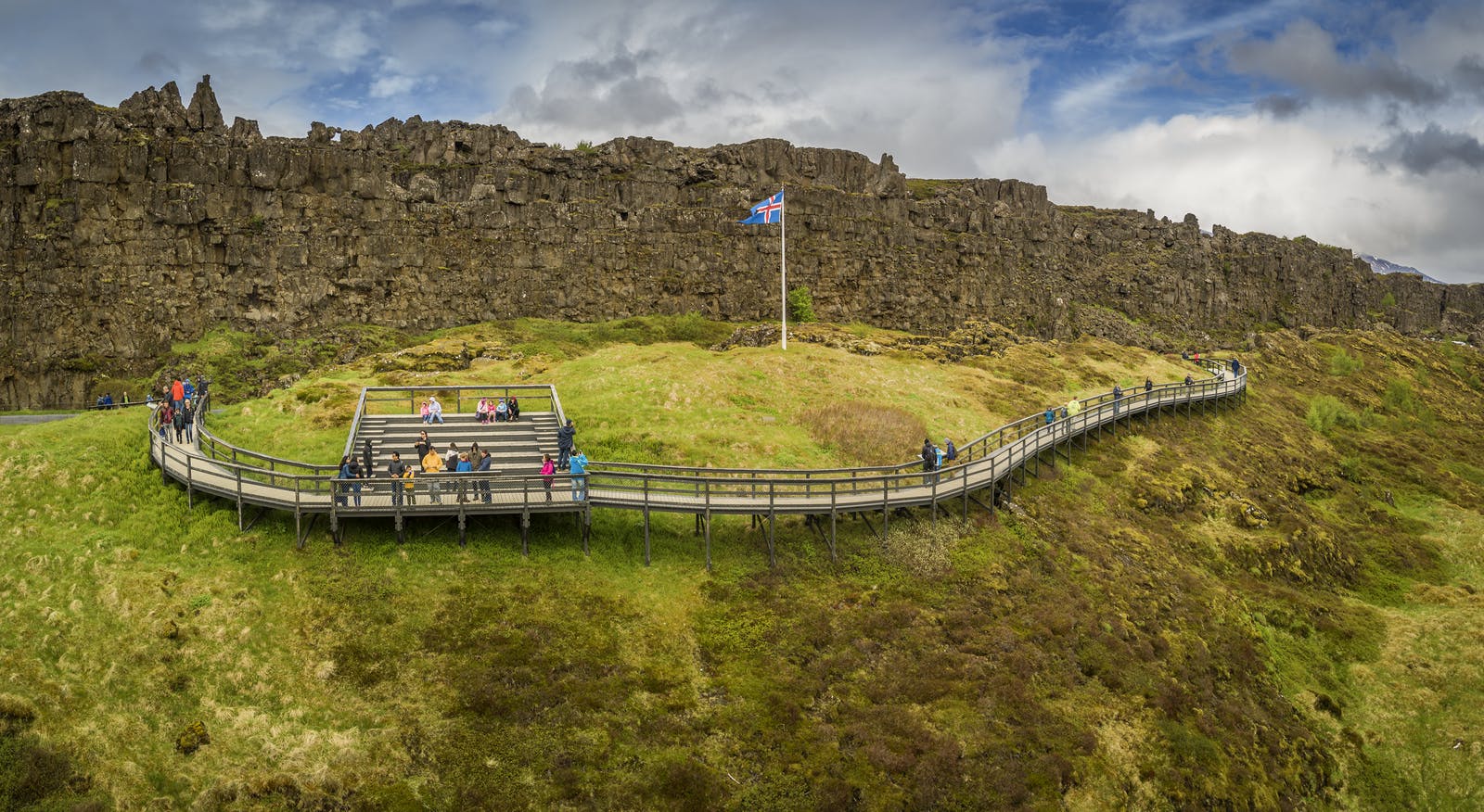
Beyond its geological wonders, Þingvellir holds a pivotal role in Icelandic history. In the year 930 AD, the Alþingi, the oldest parliament in the world, was established at Þingvellir. The Alþingi, which means "All-Thing" or "General Assembly," served as a gathering place for representatives from various regions of Iceland to discuss and settle disputes, pass laws, and forge a sense of national unity.
The Alþingi met annually, drawing people from all corners of the island to Þingvellir. The Law Rock, an imposing natural podium, served as the focal point for speeches and announcements. Here, laws were proclaimed to the assembled crowds, and rulings were made by the Lawspeaker, an elected official responsible for memorising and reciting the laws.
Þingvellir, as the site of the Alþingi, represents not only the birthplace of Icelandic parliamentary democracy but also a symbol of the nation's commitment to justice and collective decision-making.
Historical Events
The historical significance of Þingvellir extends beyond the establishment of the Alþingi. It has witnessed pivotal events that have shaped Iceland's identity. One such event was the conversion to Christianity in the year 1000 AD. At Þingvellir, under the pressure of external influences, including Norway, the Alþingi decided to adopt Christianity as the official religion. This decision had profound implications for Icelandic culture and its ties to the broader European Christian community.
The rocky terrain of Þingvellir also served as a natural arena for the implementation of Viking-age justice. Later, under Christianity, the Drekkingarhylur, or "Drowning Pool," was used for the execution of women found guilty of crimes such as infanticide. The austere reality of this historical practice stands in stark contrast to the natural beauty that now envelopes Þingvellir.
FAQ
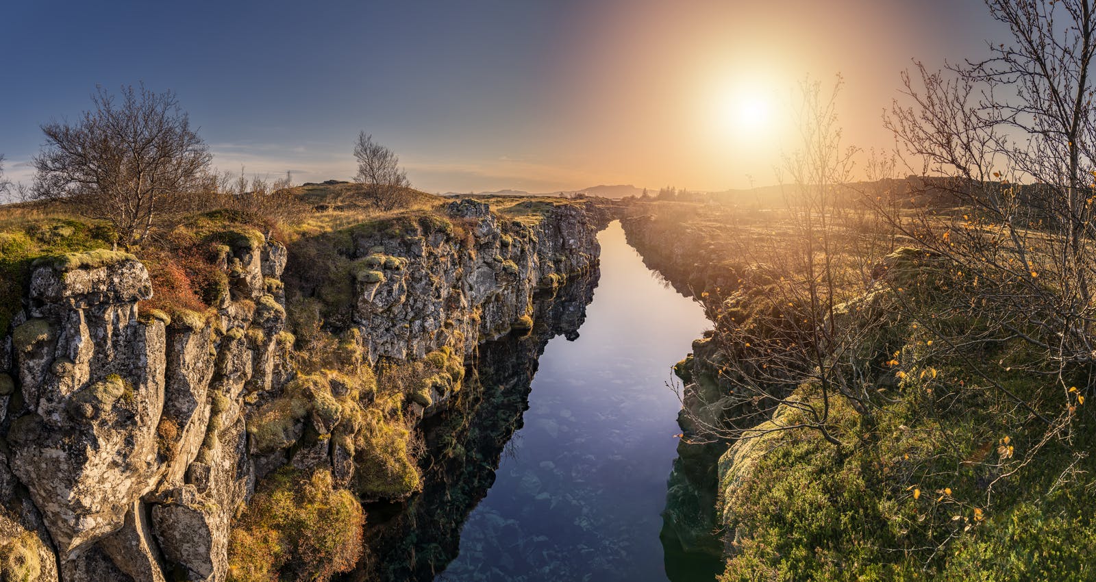
Where Can You Stand On Two Continents At Once?
One of the remarkable places where you can stand on two continents at once is Þingvellir National Park in Iceland. The park is situated on the Mid-Atlantic Ridge, where the North American and Eurasian tectonic plates meet.
How Do You Pronounce Þingvellir?
The Icelandic word "Þingvellir" is pronounced as "Thingvellir" in English. The letter "Þ" in Icelandic is called "thorn" and is pronounced as the "th" in "think." Therefore, the correct pronunciation is approximately "Thing-vet-lir."
Where Is the Best Place To See the Tectonic Plates in Iceland?
The best place to see the tectonic plates in Iceland is at Þingvellir National Park. The Almannagjá fissure, located within the park, is a visible and accessible representation of the Mid-Atlantic Ridge, where the North American and Eurasian plates are slowly drifting apart.
Which Country Has A National Park That Allows You To Walk Between Two Continents?
Iceland is a country that has a national park allowing visitors to walk between two continents.


