
Reykjanes Earthquakes 2023
Earthquakes are common occurrences before a volcanic eruption in Iceland. For instance, seismic swarms hit the Reykjanes Peninsula in southwest Iceland in late October 2023 and Following an extended period of anticipation, a volcanic eruption occurred on December 18th, lasting for three days.
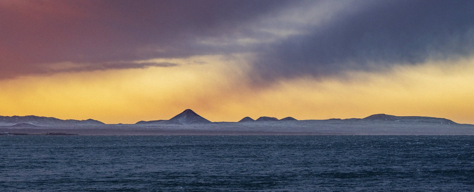
Iceland is a seismic and volcanic hot spot as the North American and Eurasian tectonic plates move in opposite directions. Follow seismic activity in the Reykjanes Peninsula here.
Reykjanes Seismic Activity in 2023
On October 25, 2023, the Reykjanes Peninsula began experiencing escalating seismic activity, marked by over 10,500 earthquakes, including numerous tremors above magnitude 3.0. The region, particularly around Mount Þorbjörn, showed significant ground deformation and continuous uplift, indicating that magma was moving beneath the surface.
This trend intensified in early November, with some earthquakes exceeding magnitude 4.0. The increased seismic activity, coupled with ground lifting and sulfur dioxide emissions near Grindavík, pointed towards ongoing magma activity close to the surface.
By mid-November, the situation reached a critical stage. Earthquake frequency and intensity surged, particularly around the Sundhnúkur Crater and Grindavík area, with a focus on a 5km long magma dyke. This culminated in a state of emergency and the evacuation of Grindavík following a magnitude 4.1 earthquake near Sýlingarfell mountain on November 10.
By November 16, despite no major changes, the volcanic situation remained precarious, maintaining a high likelihood of an eruption at the magma dyke location. However, by December 6, geodetic modeling suggested that magma inflow to this dike had ceased, reducing the chances of an eruption there, while ongoing magma accumulation beneath Svartsengi increased the likelihood of a smaller-scale future eruption.
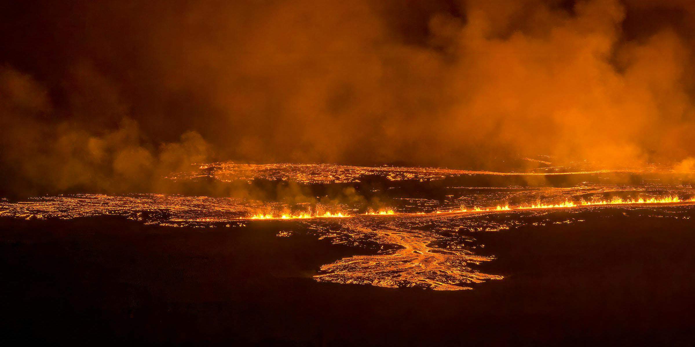
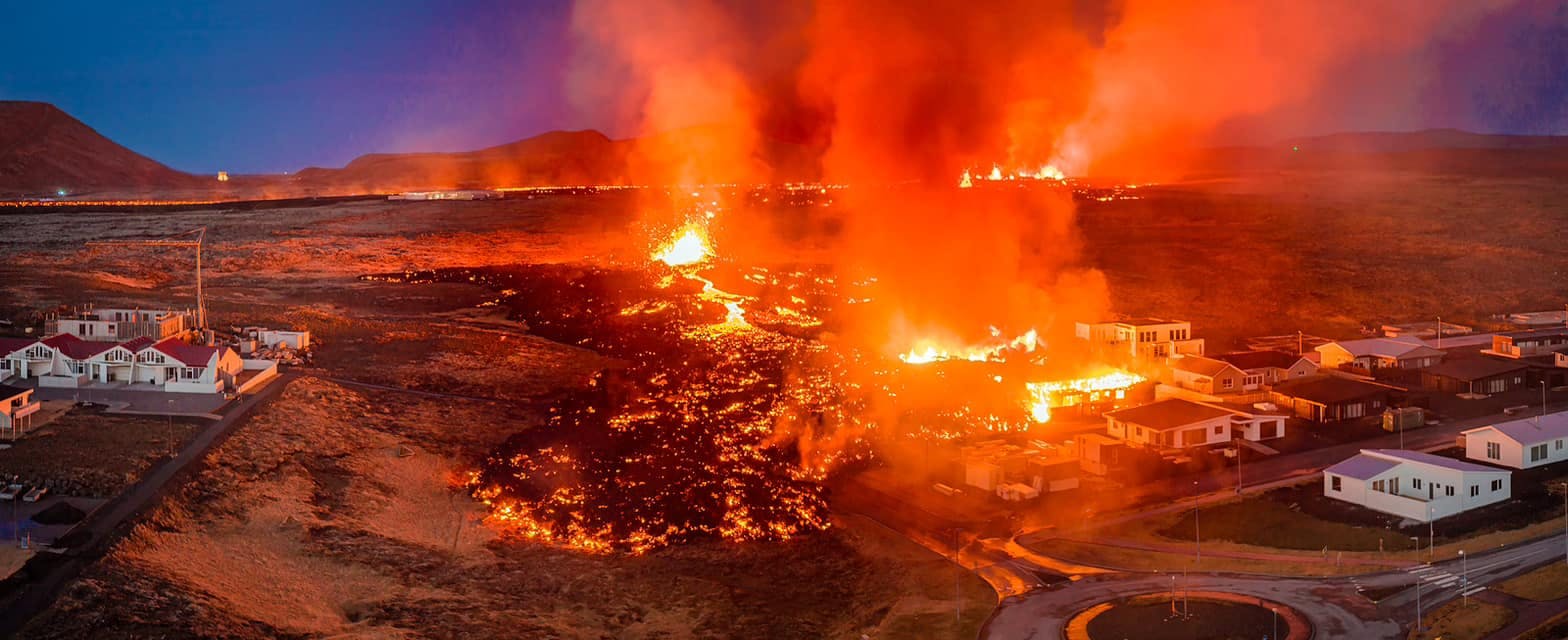
With few preeminent signs, a volcanic eruption began on December 18th at 22:17. Leading up to it was an earthquake storm at 21:00. Following the next days, the seismic activity continued to decrease, and the eruption officially ceased three days later.
From Earthquakes to Eruption
The seismic activity in the Reykjanes area of Iceland, spanning from October 25th to December 22nd, presents a remarkable sequence of geological events, characterized by fluctuating earthquake occurrences and signs of significant underground magma movements.
Initially, the seismic unrest began on October 25th with over 1000 earthquakes, notably including magnitudes 3.9 and 4.5, but with no major ground deformation detected. This pattern of activity continued, with a noticeable uptick in seismic events and ground changes around Mount Þorbjörn and the areas of Svartsengi and Þorbjörn. By November 10th, the situation had escalated, with intensified seismic activity towards Grindavík, signaling a possible magma intrusion, leading to a state of emergency and the evacuation of Grindavík. This was highlighted by a significant 4.1 magnitude quake near Sýlingarfell.
Over the following weeks, the region experienced continuous earthquake swarms, ground uplift, and magma accumulation indications. Notably, November 17th marked an increase in seismic activity with about 2000 earthquakes, primarily north of Hagafell, suggesting significant underground magma movement.
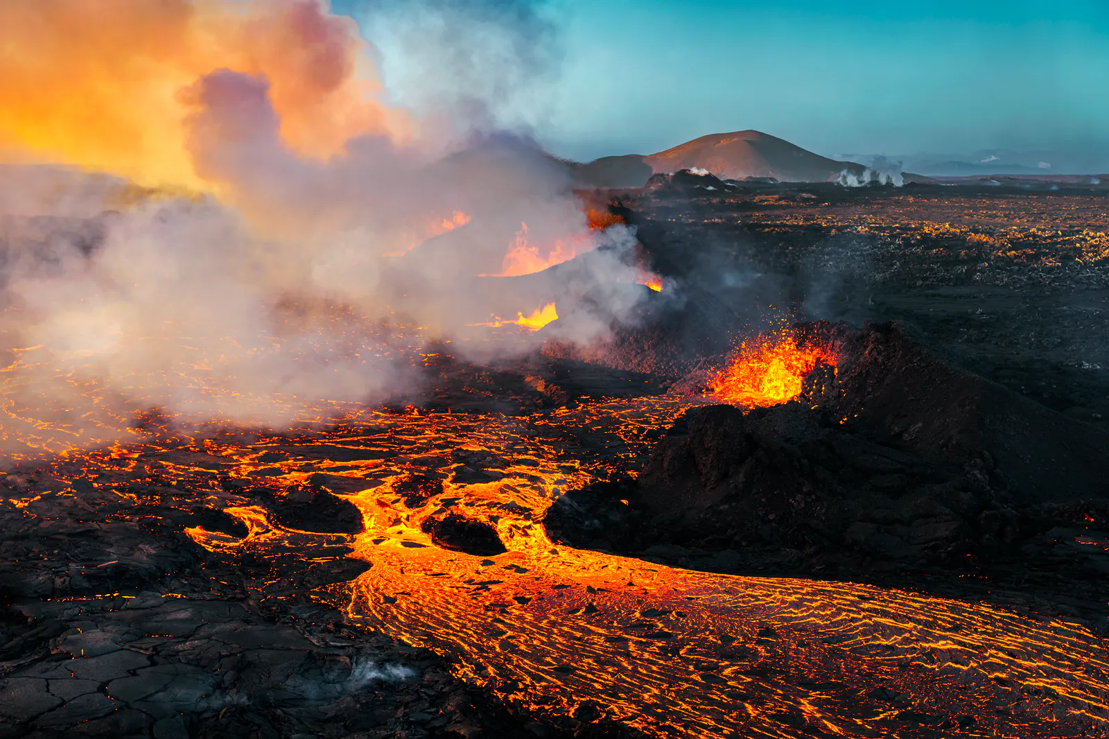
The situation peaked in mid-December with an eruption close to Sundhnúkagígar crater row, preceded by an earthquake swarm that started on the evening of December 18th. This was followed by a decrease in earthquake activity and ongoing magma accumulation beneath Svartsengi, raising the potential for new magma propagation.
However, by December 20th, there was a notable reduction in seismic activities, and the volcanic activity appeared to have ceased by December 21st. The Icelandic Met Office, following confirmation of the end of the eruption, issued a new hazard assessment, keeping the hazard level considerable for Grindavík. Residents were allowed to return at their own risk, with some planning to spend Christmas in the town, marking a cautious but hopeful respite after weeks of geological turmoil.
From Earthquakes to Eruption
The seismic activity in the Reykjanes area of Iceland, spanning from October 25th to December 22nd, presents a remarkable sequence of geological events, characterized by fluctuating earthquake occurrences and signs of significant underground magma movements.
Initially, the seismic unrest began on October 25th with over 1000 earthquakes, notably including magnitudes 3.9 and 4.5, but with no major ground deformation detected. This pattern of activity continued, with a noticeable uptick in seismic events and ground changes around Mount Þorbjörn and the areas of Svartsengi and Þorbjörn. By November 10th, the situation had escalated, with intensified seismic activity towards Grindavík, signaling a possible magma intrusion, leading to a state of emergency and the evacuation of Grindavík. This was highlighted by a significant 4.1 magnitude quake near Sýlingarfell.
Over the following weeks, the region experienced continuous earthquake swarms, ground uplift, and magma accumulation indications. Notably, November 17th marked an increase in seismic activity with about 2000 earthquakes, primarily north of Hagafell, suggesting significant underground magma movement.
The situation peaked in mid-December with an eruption close to Sundhnúkagígar crater row, preceded by an earthquake swarm that started on the evening of December 18th. This was followed by a decrease in earthquake activity and ongoing magma accumulation beneath Svartsengi, raising the potential for new magma propagation.
However, by December 20th, there was a notable reduction in seismic activities, and the volcanic activity appeared to have ceased by December 21st. The Icelandic Met Office, following confirmation of the end of the eruption, issued a new hazard assessment, keeping the hazard level considerable for Grindavík. Residents were allowed to return at their own risk, with some planning to spend Christmas in the town, marking a cautious but hopeful respite after weeks of geological turmoil.
Previous Eruptions on the Reykjanes Peninsula
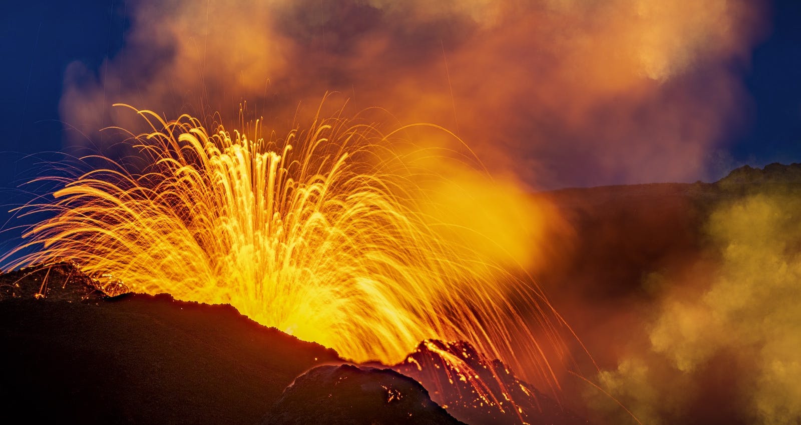
The Reykjanes Peninsula in Iceland has experienced a remarkable resurgence in volcanic activity since 2021, marking an end to 815 years of dormancy. The initial awakening occurred on 19 March 2021 with a fissure vent opening in Geldingadalir, south of the Fagradalsfjall mountain. This eruption, releasing fresh lava, continued until 18 September 2021.
Following this, another eruption began on 3 August 2022 and concluded on 21 August 2022, closely resembling the 2021 event in nature and impact. However, the volcanic activity did not cease there. After a brief period, on 10 July 2023, a new eruption commenced, characterized by a 900-metre-long fissure in the Fagradalsfjall volcano system, an area that had not experienced such activity for centuries. This eruption, which lasted until 5 August 2023, saw magma forcefully breaking through the surface, creating spectacular lava fountains. The site of this eruption was aptly named Litli-Hrútur (Little Ram).
This eruption in 2023, the third in the region since 2021, was preceded by intense earthquake activity, signaling the reawakening of the Reykjanes Peninsula. Thousands of earthquakes were recorded over several days leading up to the eruption, capturing the attention and excitement of both locals and tourists. Despite being an uninhabited area, these volcanic events have highlighted the dynamic and ever-changing nature of Iceland's geological landscape. The Reykjanes Peninsula, once quiet for over eight centuries, now continues to quake and spew lava, reshaping its topography and captivating the world.
Iceland is one of the most volcanically active regions in the world — if you’re curious which ones are still rumbling, explore the active volcanoes in Iceland.
Where Can You Learn About Volcanoes in Iceland?
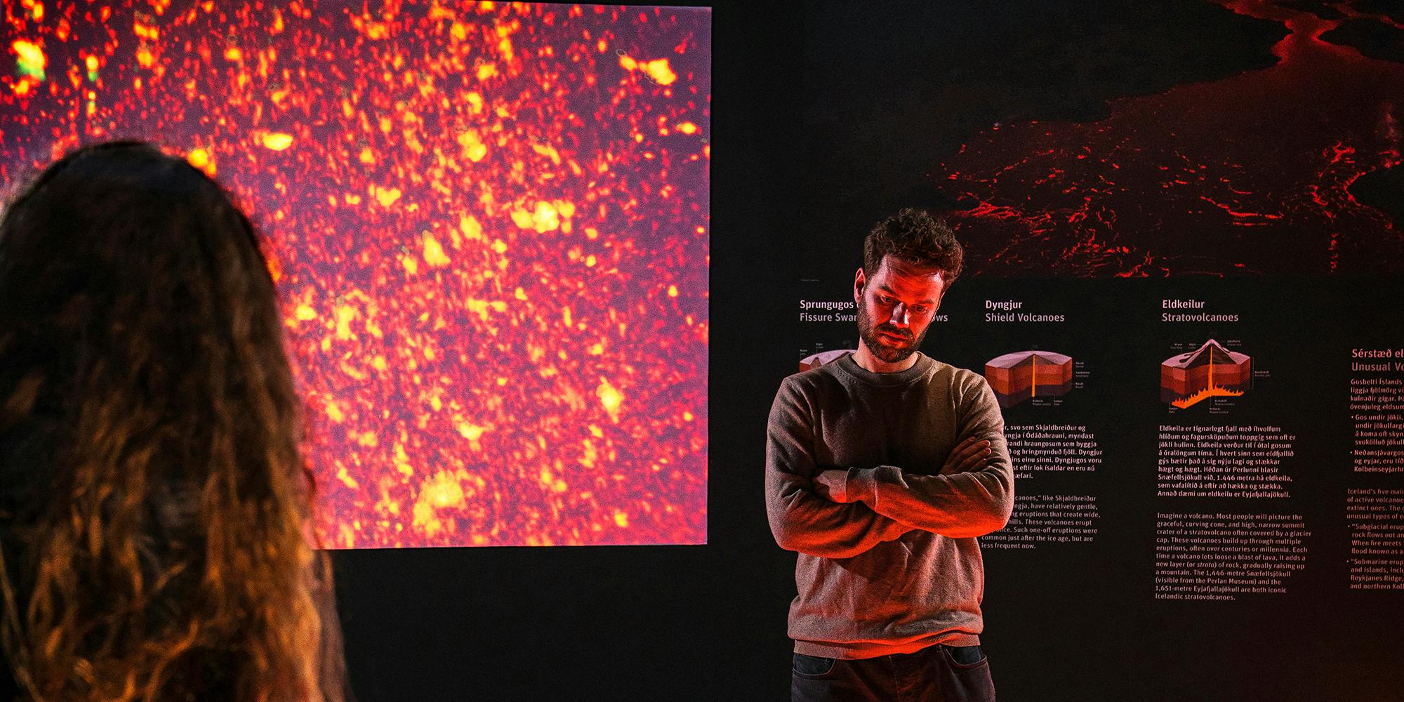
Perlan’s Forces of Nature exhibition allows guests to feel the power of volcanoes, earthquakes, and geothermal energy that powers the island. Guests will learn that volcanoes form when heat and pressure build up beneath the earth’s surface. The earth’s weak points tend to be along fault lines where tectonic plates converge or diverge, as in Iceland’s case.
Perlan’s exhibition shows that volcanic activity in Iceland is so diverse that researchers typically speak of “volcanic systems” rather than individual volcanoes. The island has 30 active volcanic systems, each with many types of volcanoes.
FAQ
What would happen if there is an eruption on the Reykjanes peninsula?
The result of an eruption would depend on its size. There would likely be earthquakes before the eruption, and warnings would be issued by authorities. Tours to the region would be cancelled, and roads to the area would be closed if warranted. Geologists are constantly monitoring the volcanoes on the island, and procedures are in place to keep people safe in the event of an eruption.
Is it safe to visit an eruption site?
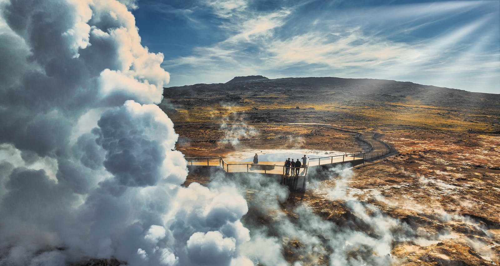
There are several factors to consider before visiting an erupting volcano. When a volcano erupts, visibility can be low, and dangerous gas levels can shift quickly and be harmful. Make sure you check safetravel.is for the latest updates on safety conditions. The authorities can always close access to the hiking trail if gas levels reach a dangerous level or if weather conditions are poor.
Popular articles
Let's Talk About the Volcano in Iceland About to Erupt
Is a volcano in Iceland about to erupt? Here’s what travelers should know about Svartsengi, Reykjanes activity, flights, safety, and the Blue Lagoon.
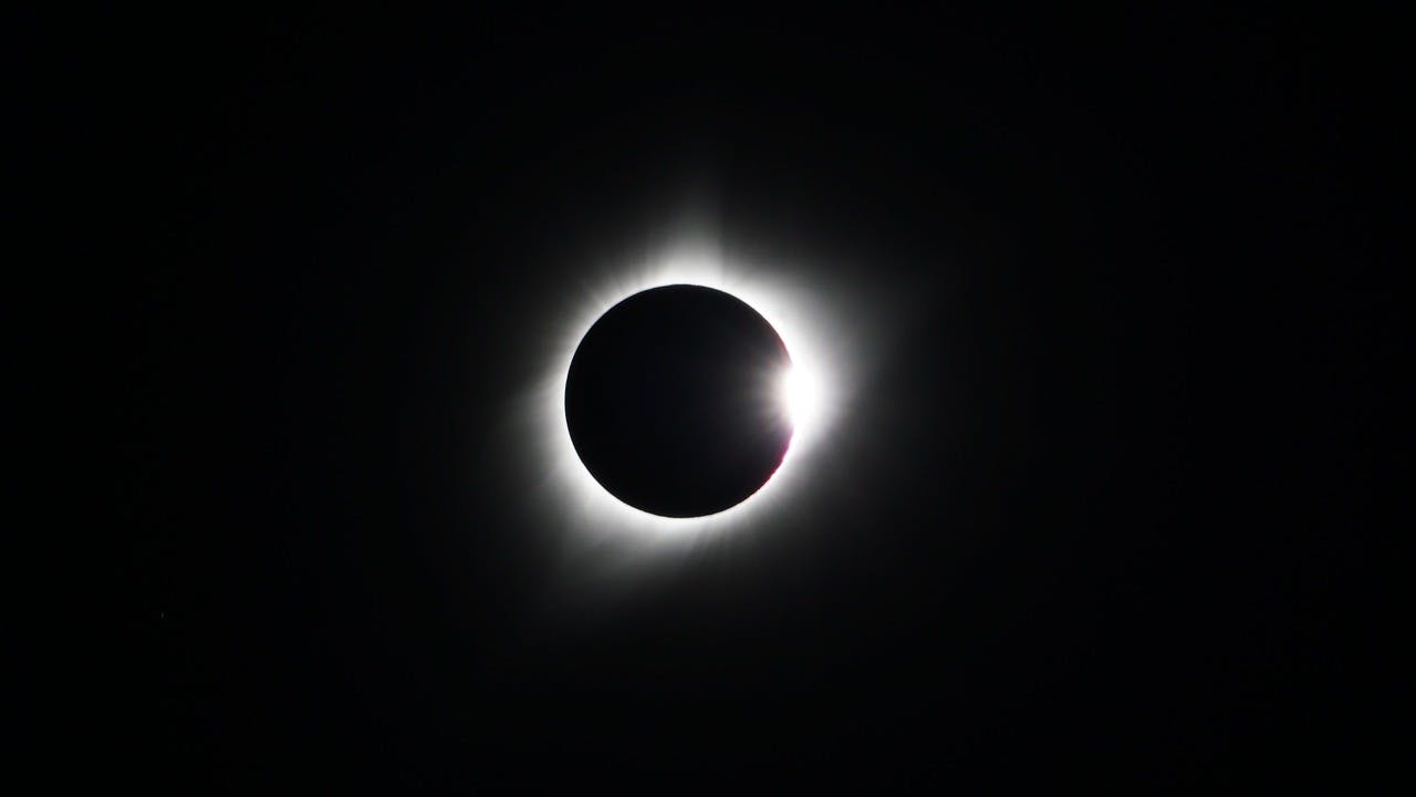
Guide to the Solar Eclipse 2026
Plan your trip to witness the Solar Eclipse 2026 in Iceland! Discover the best viewing spots, key times, safety tips, and travel advice for this rare celestial event.

July 2026 updates on the Sundhnúkagígar Eruption in the Reykjanes Peninsula!
The current eruption in the Reykjanes Peninsula, is called Sundhnúkagígar Crater Row. See insights on the seismic activity and volcanic eruptions in the area!
Active Volcanoes in Iceland 2026
Active volcanoes aren't the same thing as active eruptions. A volcano can be considered active even when it is not ejecting ash, rock, gases and magma, so which are active in Iceland in 2026?

Top 10 Places To See the Northern Lights in Iceland
You can see the northern lights across the country, but some spots are more suitable than others. Find the best place to see the northern lights in Iceland.

Ice Caves From Reykjavik
Travel beyond the capital for a closer look at an ice cave under one of Iceland’s glaciers. If you can’t spare the time, experience Perlan’s ice cave in Reykjavik.