
Guide to Hverfjall Volcano and Crater
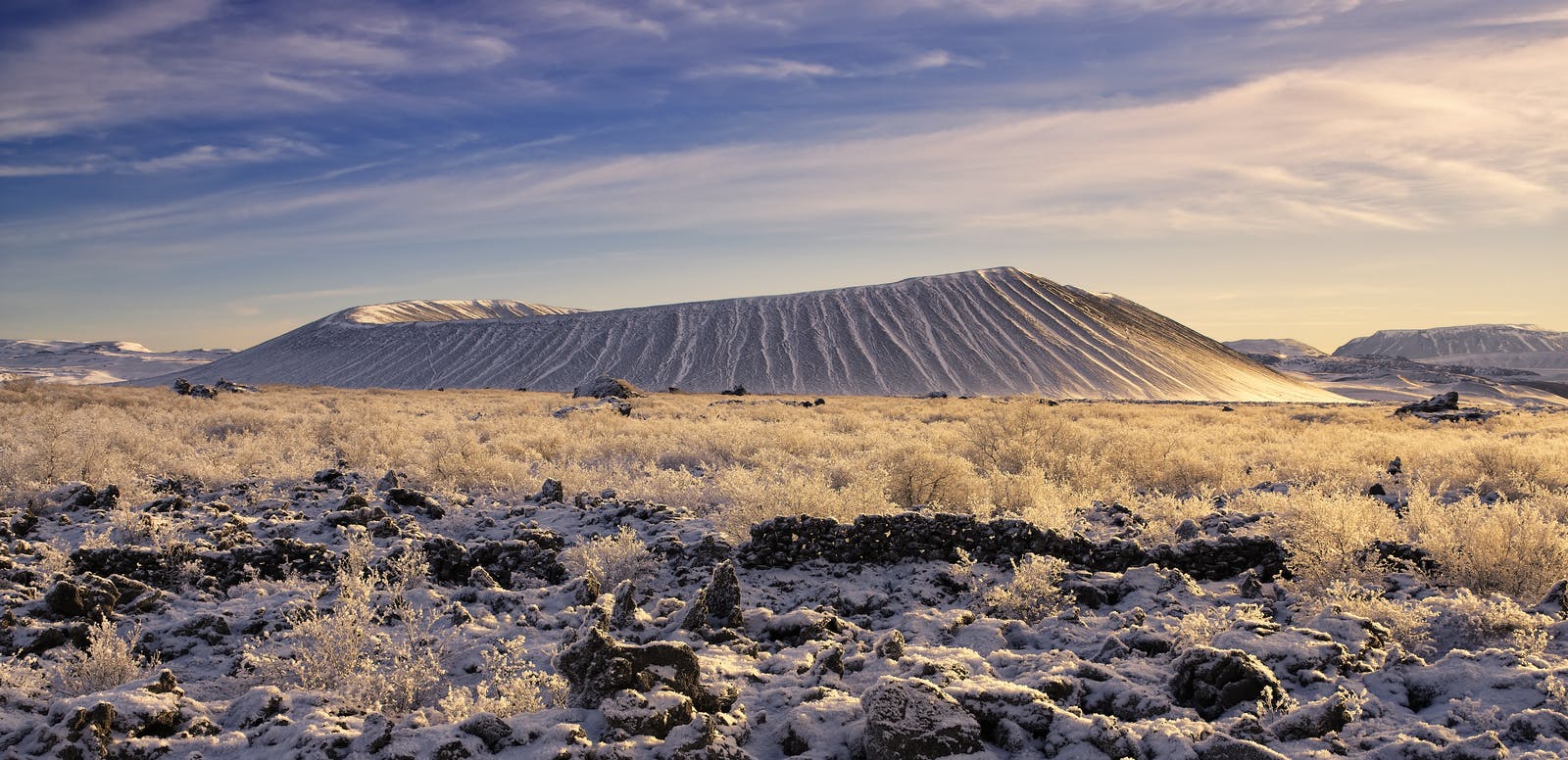
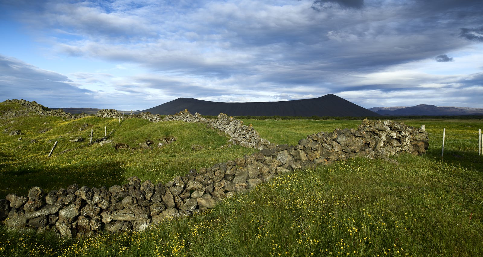
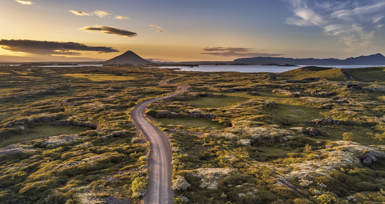
Hverfjall is a 396-metre-high tephra explosion crater near the eastern shore of Lake Myvatn in North Iceland. It resembles a towering black ash cone with steep slopes and a massive rim. It is one of the world's largest and most well-preserved explosion volcanic craters and is a popular destination for hikers, geology enthusiasts, and tourists.
What type of volcano is Hverfjall?
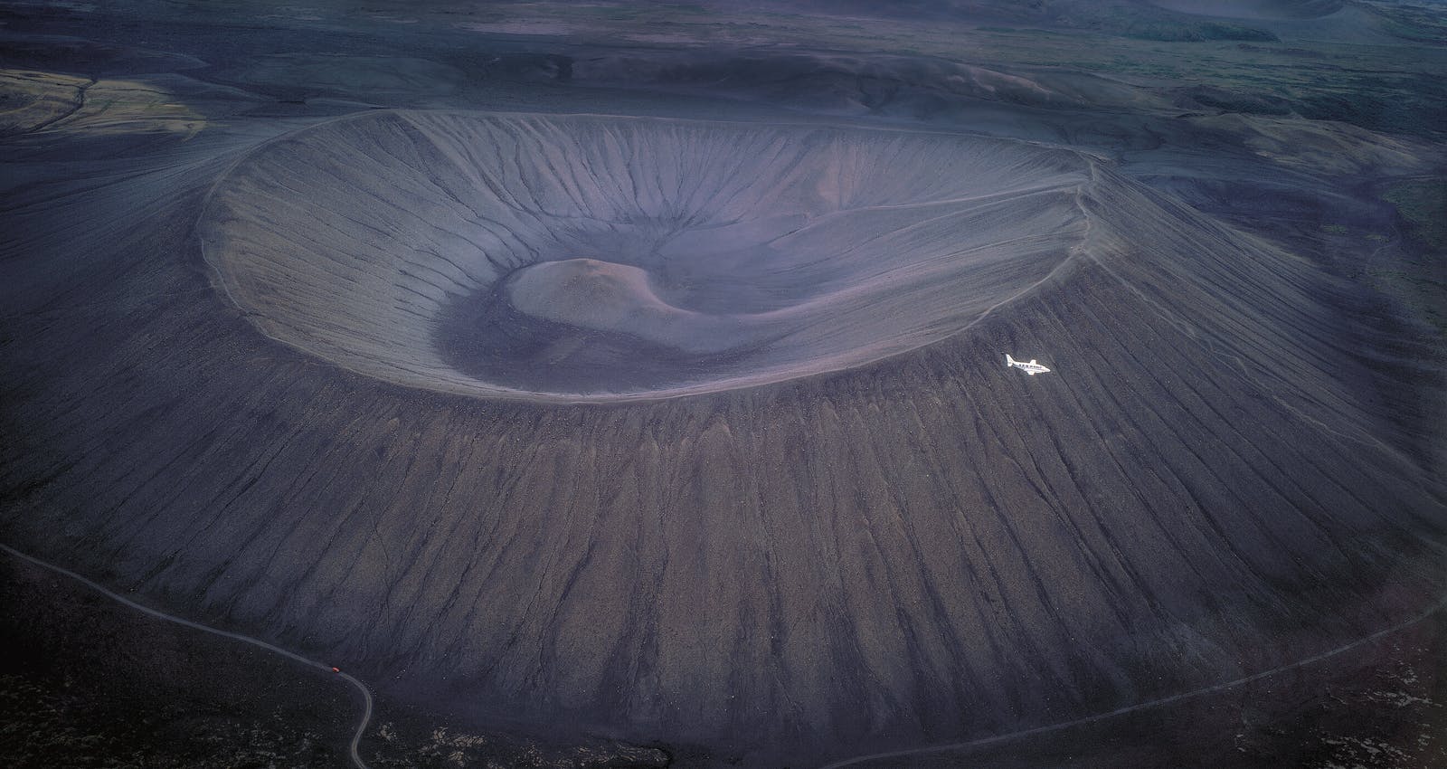
During a volcanic eruption, Hverfjall, a tephra explosion crater, was formed around 2,800 years ago. Explosions associated with the eruption created a massive crater, resulting in the distinctive circular shape of the formation we see today.
The crater has a diameter of about 1 kilometre (0.62 miles) and rises to a height of approximately 420 meters (1,378 feet) above the surrounding landscape. Its steep walls make for an impressive sight from both near and far.
Iceland is one of the most volcanically active regions in the world — if you’re curious which ones are still rumbling, explore the active volcanoes in Iceland.
How to get to Mount Hverfjall
Hverfjall is easily accessible from the Ring Road (Route 1) in northern Iceland. There's a designated parking area, and a marked trail leads to the crater's rim.
Can you hike Mount Hverfjall?
Hverfjall is a popular hiking destination. Visitors can hike along the well-defined trail that leads up to the rim of the crater. The hike is relatively steep but short, taking around 20-30 minutes to reach the edge. The rewarding panoramic views from the top make it worth the effort. There are two paths up, one from the northwest and the other from the south.
It is strictly forbidden to use different routes or leave the paths due to the fragility of nature. The hike up to the rim takes about 20 minutes, and once on top, you will be rewarded with a beautiful view over Lake Myvatn, Dimmuborgir and the surrounding lava fields, especially when the sky is clear.
What attractions are close to Hverfjall?
Lake Mývatn
This picturesque lake is a central attraction in the region. Known for its stunning beauty and unique geology, Lake Mývatn offers birdwatching, boating, and exploration opportunities. The lake's surroundings include pseudocraters, geothermal areas, and lava formations.
Dimmuborgir
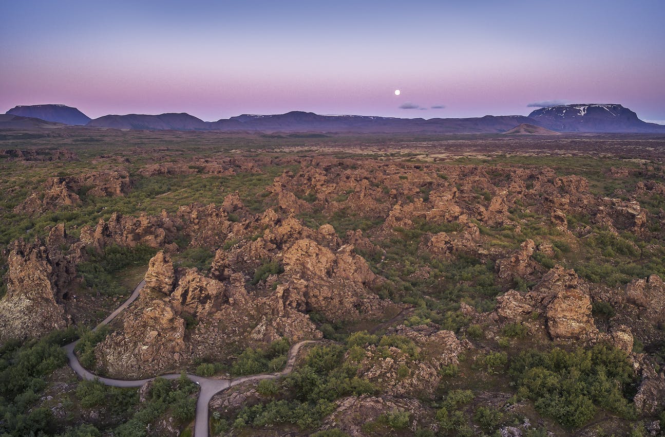
Dimmuborgir, which means "dark castles," resembles a fort guarding an ancient city. The black lava pillars were born from a collapsed lava tube created by a large volcanic eruption over 2,000 years ago.
Dimmuborgir was formed during an eruption when a pool of molten lava all of a sudden was emptied. The strange rock formations in the site are lava that had solidified before the pool was emptied.
A popular photo opportunity in the Kirkjan (the Church) structure is a curved lava caveresembling a steeple. While it's tempting to scale many structures, climbing is strictly prohibited.
Krafla
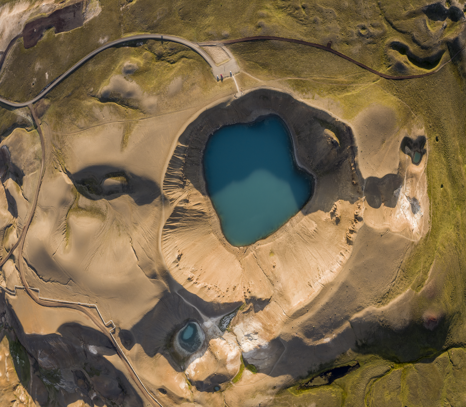
The Krafla lava fields are home to Víti (Hell), one of the best-known craters in Iceland. Víti is enormous, about 300 metres in diameter. The crater was formed during a massive volcanic explosion during an eruption in 1724. Today, you can visit this region to glimpse the crater, hike around the area, and take in the wildly alive hot springs and mud pools.
Skútustaðagígar Pseudocraters
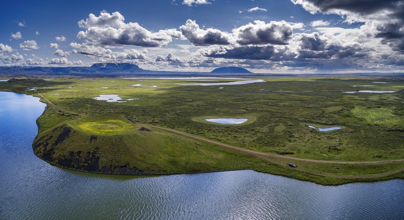
Skútustaðagígar pseudo craters are a fascinating geological phenomenon in which the craters were formed by gas explosions when hot lava from volcanic eruptions flowed over the wet, cool, marshy area.
The craters are a popular site for bird watchers and are protected as a natural wetland conservation area. The craters formed when steam was trapped under the lava, leading to extreme pressure and explosions about 2,300 years ago.
Mývatn Nature Baths
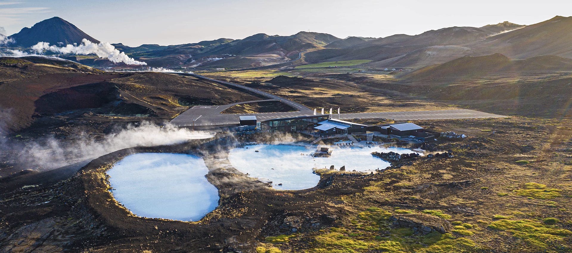
Despite frequent comparisons to the Blue Lagoon, the Mývatn Nature Baths, 3 kilometres east of Reykjahlíð, have unique personalities and atmospheres. The bathing experience is unrivalled, and the views of the landscape are striking, with the volcanic crater of Hverfjall and the edge of Lake Mývatn in the background.
The water temperature reaches a scorching 130°C when it arrives at the basin next to the lagoon, but it cools significantly before filtering into the glorious human-made hot spring. The basin and lagoon hold about 2.5 million litres of water.
Where Can You Learn About Volcanoes in Iceland?
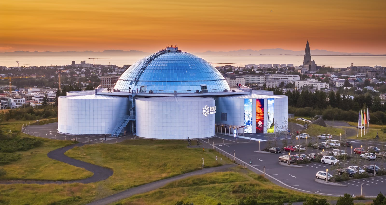
Perlan's' Forces of Nature exhibition allows guests to feel the power of volcanoes, earthquakes, and geothermal energy that powers the island. Guests will learn that volcanoes form when heat and pressure build beneath the earth's surface. The earth's weak points tend to be along fault lines where tectonic plates converge or diverge, as in Iceland's' case.
Perlan's exhibition shows that volcanic activity in Iceland is so diverse that researchers typically speak of "volcanic systems" rather than individual volcanoes. The island has 30 active volcanic systems, each with many types of volcanoes.
Popular articles
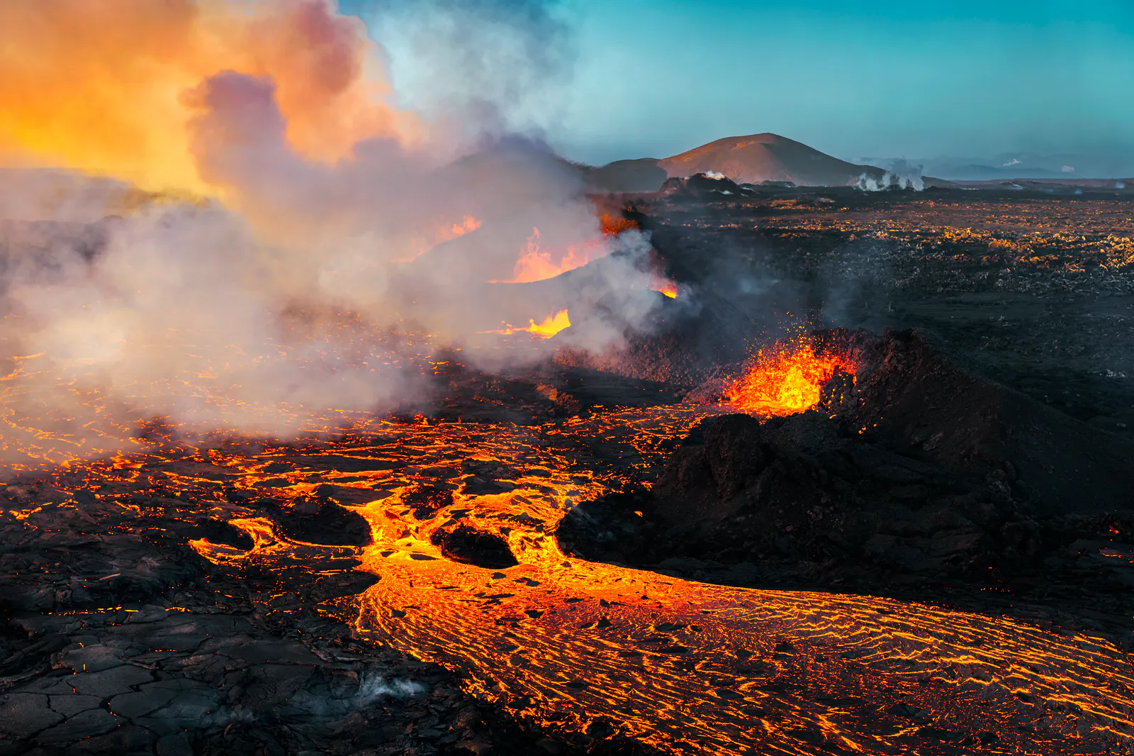
Let's Talk About the Volcano in Iceland About to Erupt
Is a volcano in Iceland about to erupt? Here’s what travelers should know about Svartsengi, Reykjanes activity, flights, safety, and the Blue Lagoon.
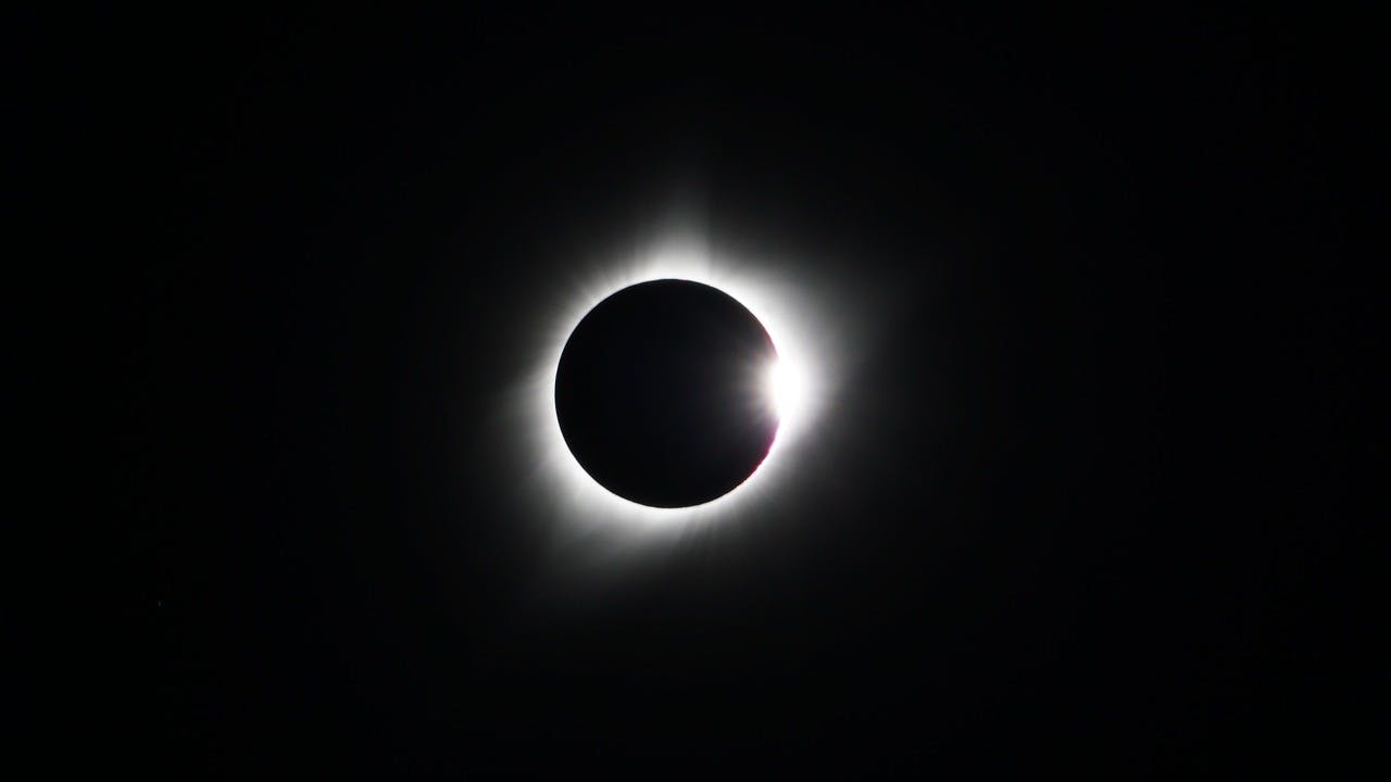
Guide to the Solar Eclipse 2026
Plan your trip to witness the Solar Eclipse 2026 in Iceland! Discover the best viewing spots, key times, safety tips, and travel advice for this rare celestial event.

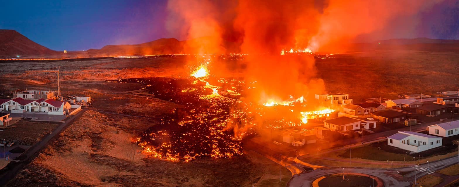
July 2026 updates on the Sundhnúkagígar Eruption in the Reykjanes Peninsula!
The current eruption in the Reykjanes Peninsula, is called Sundhnúkagígar Crater Row. See insights on the seismic activity and volcanic eruptions in the area!
Active Volcanoes in Iceland 2026
Active volcanoes aren't the same thing as active eruptions. A volcano can be considered active even when it is not ejecting ash, rock, gases and magma, so which are active in Iceland in 2026?

Top 10 Places To See the Northern Lights in Iceland
You can see the northern lights across the country, but some spots are more suitable than others. Find the best place to see the northern lights in Iceland.

Ice Caves From Reykjavik
Travel beyond the capital for a closer look at an ice cave under one of Iceland’s glaciers. If you can’t spare the time, experience Perlan’s ice cave in Reykjavik.