
Guide to Hengifoss Waterfall in Iceland
Hengifoss is a captivating natural wonder nestled in the heart of East Iceland, renowned not only for its stunning beauty but also for the geological secrets it unveils. This majestic waterfall is situated in the lush landscape near the town of Egilsstaðir. It has become a must-visit destination for both nature enthusiasts and scientists seeking to unravel the geological mysteries it holds.
Hengifoss, with its towering cascade and vibrant rock layers, stands as a geological masterpiece. Beyond its touristic appeal, this Icelandic waterfall unveils a rich tapestry of geological history, from volcanic eruptions to the slow formation of basalt columns. The interplay of hydrology, glacial influence, and ecological adaptation creates a complex ecosystem that adds to the allure of Hengifoss.
Physical Characteristics & Geological Formations
Size and Height
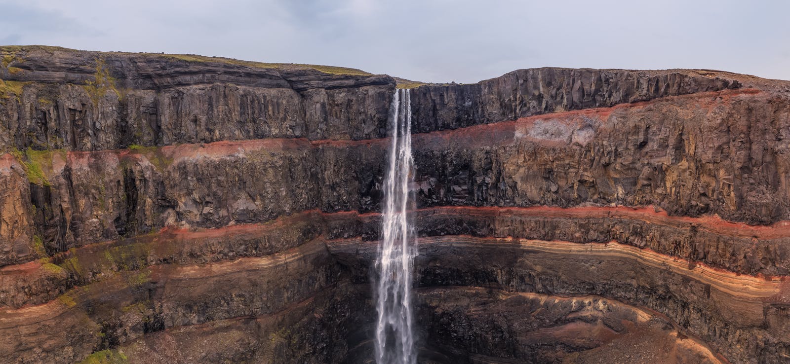
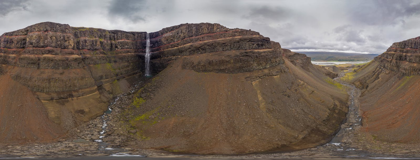
Hengifoss is an imposing waterfall, standing at an impressive height of approximately 128 metres (420 feet). The cascading water creates a mesmerising spectacle as it descends over a series of striking, colourful rock layers. This makes Hengifoss the third-highest waterfall in Iceland, contributing to its allure and drawing visitors from around the globe.
Rock Layers
One of the most distinctive features of Hengifoss is the captivating display of multi-coloured rock layers surrounding the waterfall. The layers showcase a geological timeline, providing a unique glimpse into the Earth's history. The rocks consist mainly of basaltic layers interwoven with red sedimentary layers, creating a visually striking contrast. The sedimentary layers consist of silt- and sandstone. Lignite and other plant remains can be found in some places, revealing the ancient climate. The layers date back to the Miocene period, offering scientists valuable insights into past volcanic activity, climate and environmental conditions.
Basalt Columns
The basalt columns that form the backbone of Hengifoss are a geological phenomenon seen in various parts of the world. These columns result from the slow cooling and solidification of lava, a process known as columnar jointing. As the lava cools, it contracts and fractures into polygonal columns, forming the distinct vertical structures observed at Hengifoss. The basalt columns contribute to the waterfall's aesthetic appeal and serve as a geological record of ancient volcanic events.
Volcanic History
The entire region surrounding Hengifoss is a testament to Iceland's tumultuous volcanic history. The layers of basalt and other volcanic rocks indicate past volcanic eruptions and the subsequent deposition of lava. Studying these layers allows geologists to reconstruct the chronology of volcanic events, offering valuable insights into the geological evolution of the area over millions of years.
Water Source: River Hengifossaá
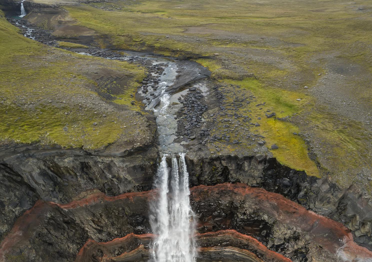
Hengifoss is fed by the river Hengifossaá, which originates from Lake Hengifossárvatn. The water from the lake journeys through the picturesque landscape, eventually culminating in the breathtaking cascade of Hengifoss. The river's flow and the volume of water contribute significantly to the dynamic nature of the waterfall, with seasonal variations in water volume adding an extra layer of complexity to its hydrological dynamics.
Explore All Aspects of Hengifoss
You can explore all aspects of Hengifoss without making a long trip to eastern Iceland. Perlan Museum in Reykjavík has multiple exhibitions covering subjects such as volcanoes, glaciers and water. The exhibitions are educational and entertaining, ensuring a good time for all ages.
Accessibility and Hiking
Hiking Trail
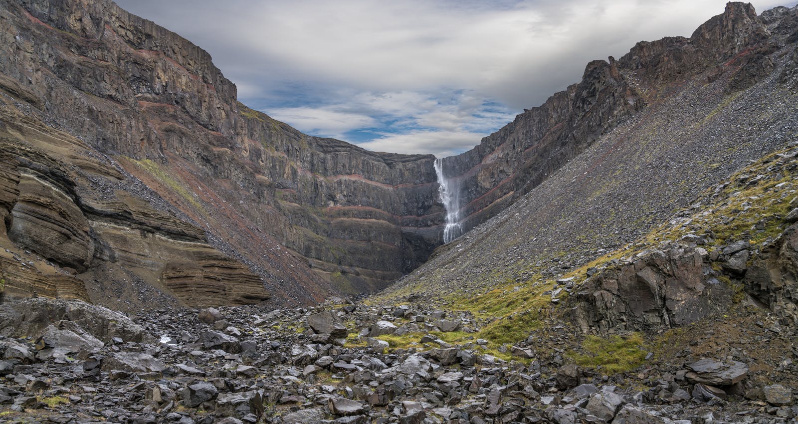
Reaching Hengifoss involves a captivating hike that traverses the picturesque Icelandic landscape. The trailhead, located near the town of Egilsstaðir, guides hikers through a scenic route, offering panoramic views of the surrounding mountains, valleys, and lakes. The journey to Hengifoss takes approximately 1.5 to 2 hours, covering a distance of about 2.5 kilometres (1.5 miles). The trek not only provides a physical adventure but also an immersive experience in the geological wonders that characterise the region.
Geological Interpretation Points
Along the hiking trail, interpretative points provide valuable information about the geological features of Hengifoss. These educational stops offer hikers the opportunity to deepen their understanding of the rock formations, volcanic history, and ecological significance of the area. Interpretative signage, often developed in collaboration with geologists and environmental scientists, enriches the overall hiking experience, transforming it into an enlightening geological exploration.
Preservation Efforts and Challenges
Conservation Initiatives
Given the ecological and geological significance of Hengifoss, conservation efforts play a crucial role in preserving this natural treasure. Local authorities and environmental organisations work to implement sustainable tourism practices, including designated trails and educational programs that promote responsible visitor behaviour. These initiatives aim to strike a balance between facilitating access to Hengifoss and ensuring the long-term preservation of its geological and ecological integrity.
Challenges of Over Tourism
The growing popularity of Hengifoss has led to an increase in tourist footfall, presenting challenges related to environmental degradation and ecosystem disturbance. Over-tourism can lead to soil erosion, trampling of delicate vegetation, and disruption of wildlife habitats. Conservationists and park authorities are grappling with the delicate task of managing visitor numbers to minimise the ecological impact while allowing people to appreciate the geological marvels of Hengifoss responsibly.
How To Get to Hengifoss From Reykjavík
The distance from Reykjavik to Hengifoss is approximately 600 kilometres (about 373 miles) when taking the most common route along the Ring Road (Route 1) through the eastern part of Iceland. The driving time can vary depending on factors such as road conditions, speed limits, and stops along the way. A rough estimation of the drive is that it would take about 8 hours.
- You should follow the Ring Road (Route 1) heading east from Reykjavik.
- Follow the Ring Road through picturesque landscapes, passing through towns like Selfoss, Hella, and Kirkjubæjarklaustur.
- Continue on Ring Road: Continue on Route 1 until you reach the town of Egilsstaðir in the eastern part of Iceland.
- From Egilsstaðir, take Road 931, heading south.
- Follow the signs to Hengifoss until you reach the parking lot at the trailhead.
FAQ
How Long Does It Take To Hike to Hengifoss?
It takes about 1.5 to 2 hours to hike to Hengifoss from the trailhead. The trail is approximately 2.5 kilometres (1.5 miles) one way. Keep in mind that this estimate can change based on individual fitness levels and weather conditions.
What Does Hengifoss Mean in English?
In English, "Hengifoss" translates to "Hanging Falls" or "Hanging Waterfall." The name is derived from the distinctive rock layers surrounding the waterfall, giving the appearance of hanging or suspended layers.
What Is The Most Famous Waterfall in Iceland?
One of the most famous waterfalls in Iceland is Gullfoss. Gullfoss, which means "Golden Falls" in Icelandic, is located in the canyon of the Hvítá River in the southwest part of the country.
Popular articles
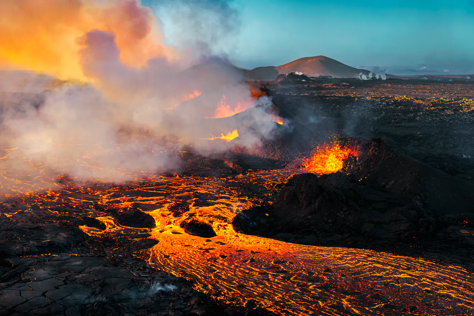
Let's Talk About the Volcano in Iceland About to Erupt
Is a volcano in Iceland about to erupt? Here’s what travelers should know about Svartsengi, Reykjanes activity, flights, safety, and the Blue Lagoon.
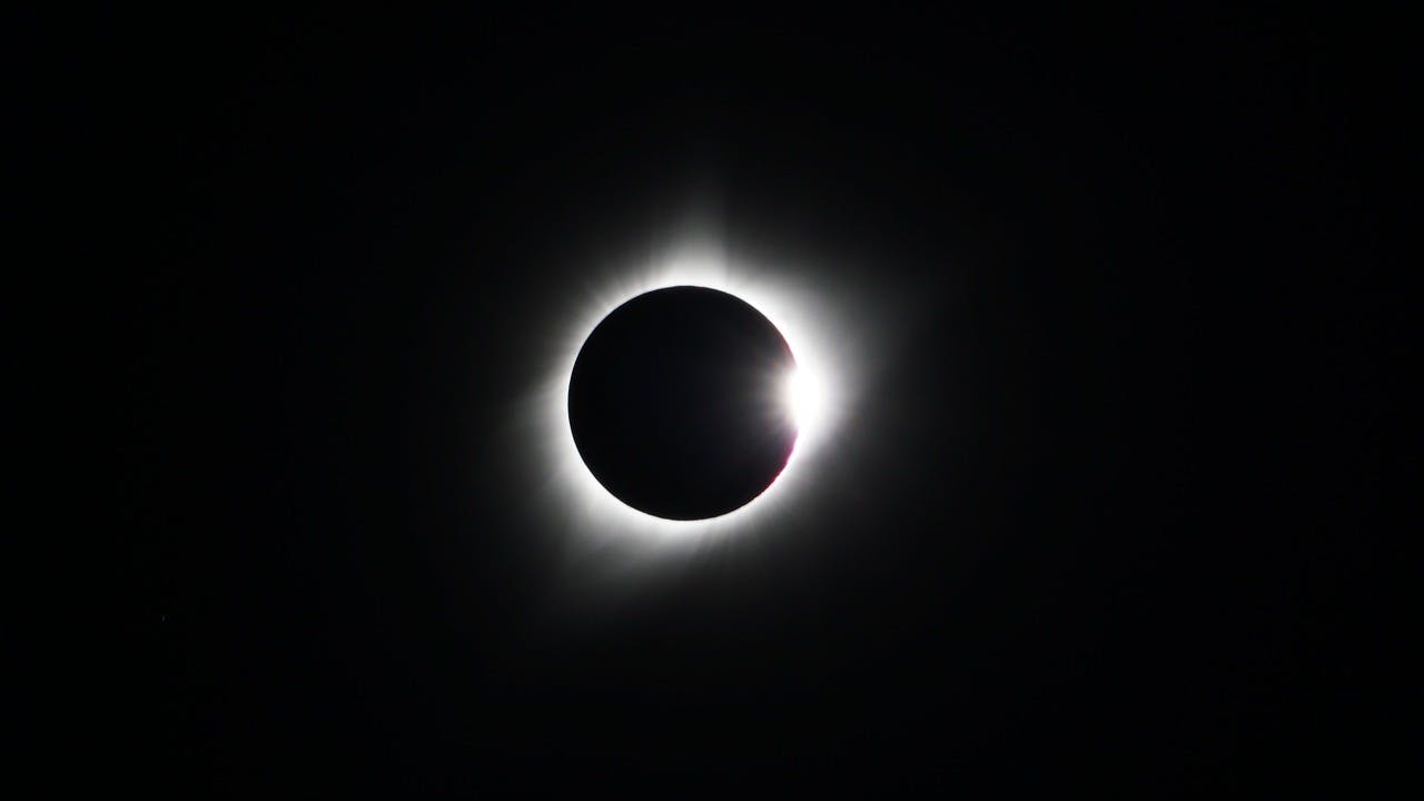
Guide to the Solar Eclipse 2026
Plan your trip to witness the Solar Eclipse 2026 in Iceland! Discover the best viewing spots, key times, safety tips, and travel advice for this rare celestial event.

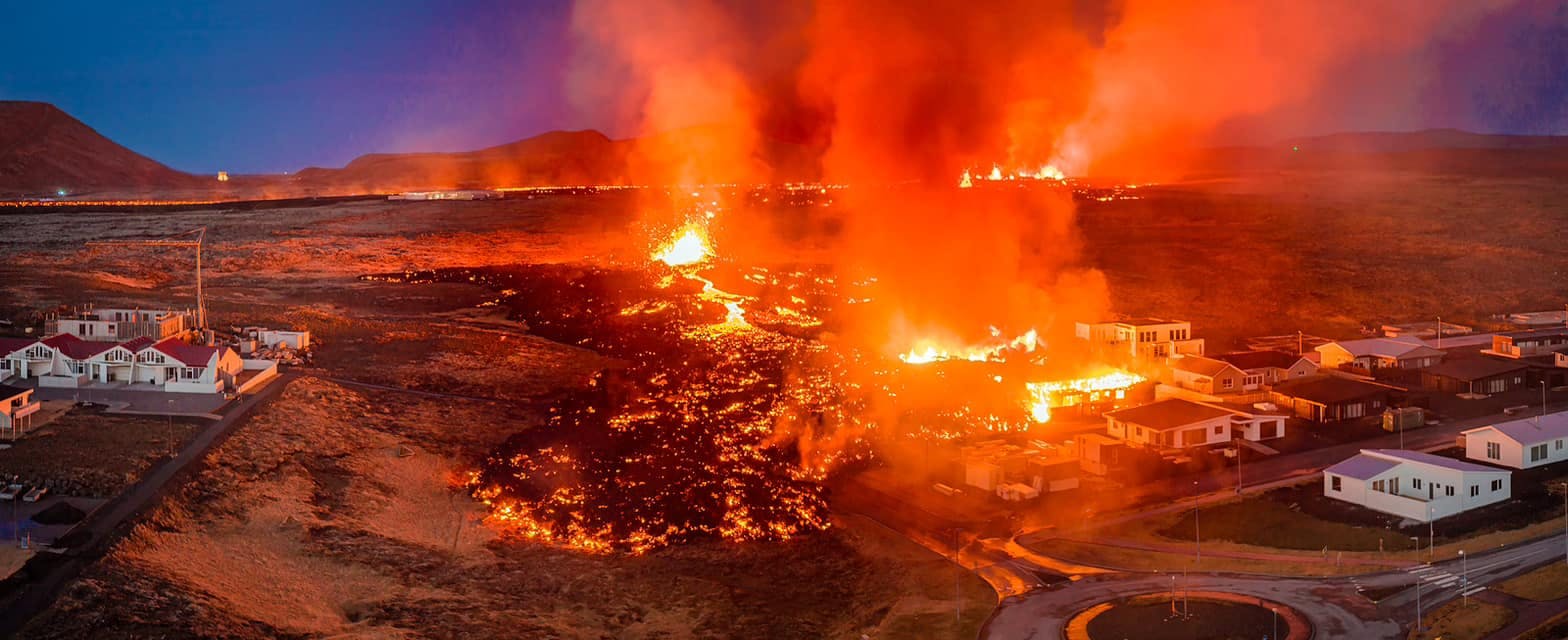
July 2026 updates on the Sundhnúkagígar Eruption in the Reykjanes Peninsula!
The current eruption in the Reykjanes Peninsula, is called Sundhnúkagígar Crater Row. See insights on the seismic activity and volcanic eruptions in the area!
Active Volcanoes in Iceland 2026
Active volcanoes aren't the same thing as active eruptions. A volcano can be considered active even when it is not ejecting ash, rock, gases and magma, so which are active in Iceland in 2026?

Top 10 Places To See the Northern Lights in Iceland
You can see the northern lights across the country, but some spots are more suitable than others. Find the best place to see the northern lights in Iceland.

Ice Caves From Reykjavik
Travel beyond the capital for a closer look at an ice cave under one of Iceland’s glaciers. If you can’t spare the time, experience Perlan’s ice cave in Reykjavik.