
Guide to Askja Volcano
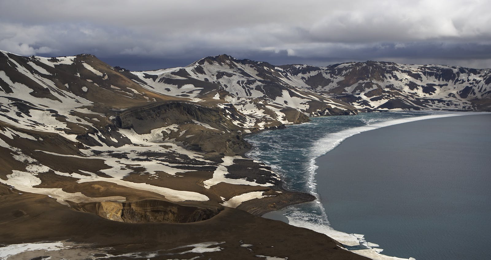
Askja is a caldera in the remote, awe-inspiring Dyngjufjöll Mountains. Essentially, huge volcanic craters and calderas are formed by collapsing land after a volcanic eruption. At 1,519 metres, Askja emerges from the Ódáðahraun lava field, and the terrain is quite rocky.
What is Viti?
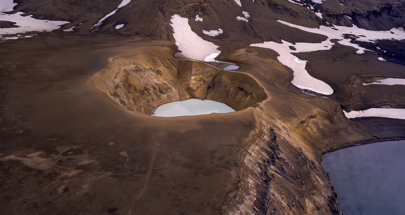
Víti is a tremendous pale blue lake-filled crater that emerged after the great eruption of the Askja volcano in 1875.
When Has Askja Erupted Throughout History?
Askja’s last eruption was in 1961, and prior to that it had several small eruptions between 1920 and 1930. In 1875 the volcano had a powerful explosive eruption with dire consequences in the eastern part of Iceland. The volcanic plume reached an altitude of 15-20 km. The ashfall was heavy enough to damage the land and kill livestock, and ash from the eruption drifted to Sweden, Norway, Germany and Poland. See more details of volcano Askja eruptions.
Large number of people left the country and emigrated to America in the following years. After the eruption a deep caldera was created. Inside it Iceland’s deepest lake, Öskjuvatn, was formed in the next decade.
Askja is an active volcano. Although there are no indications of an imminent eruption, recent seismic swarms indicate that the Askja Volcano is awakening.
Iceland is one of the most volcanically active regions in the world — if you’re curious which ones are still rumbling, explore the active volcanoes in Iceland.
Where is Askja Located?
Askja is located in the Icelandic highlands, the interior of Iceland. It takes excellent planning and an F-Road-approved vehicle to access the area.
Can You Hike to Askja?
Askja is one of the most popular destinations in the highlands. There are two mountain huts about 100 kilometres from the Ring Road. From there, it’s an 8-kilometre drive up into the Askja caldera. It is a walk of about 2.5 kilometres from the car park to the crater Víti.
Keep in mind that the roads are usually only open for about three months, from late June until September. Depending on the weather, the open period could be longer or shorter.
What Attractions are Close to Askja?
Víti Crater
Viti is a geothermal crater within the larger caldera of Askja. The word Víti translates to hell in English, and the crater is often filled with warm geothermal water. The pale blue colour is striking against the muted backdrop of the highlands.
Öskjuvatn
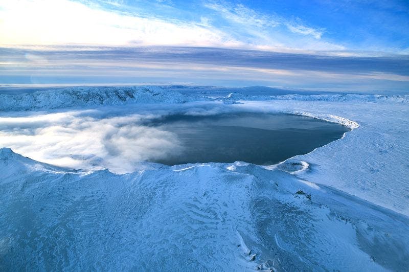
Öskjuvatn is the lake that fills the central caldera of Askja. It is the deepest lake in Iceland, reaching depths of around 220 metres. The lake’s surface is often partially covered with ice, even during the summer, due to the high elevation and cold temperatures of the central highlands.
Kverkfjöll
Kverkfjöll volcano, which reaches 1,764 metres, includes two calderas that are filled with ice. The area is striking for its range of colours, with a deep black background that gives way to gorgeous blues and icy white. The main attractions are the ice caves that were created by hot springs, slowly melting the ice into interesting shapes.
Trölladyngja
Trölladyngja is is one of the biggest shield volcanoes of Iceland reaching a height of 1,468 metres (4,816 ft) and rising almost 600 metres above the surrounding lava fields. It is cone shaped, about 10 kilometres in diameter with an oblong crater in the top about 1,200 to 1,500 metres in length, 500 metres broad, and about 100 metres deep. The volcano was formed in a long lasting eruption some 4000 years ago.
Ódáðahraun
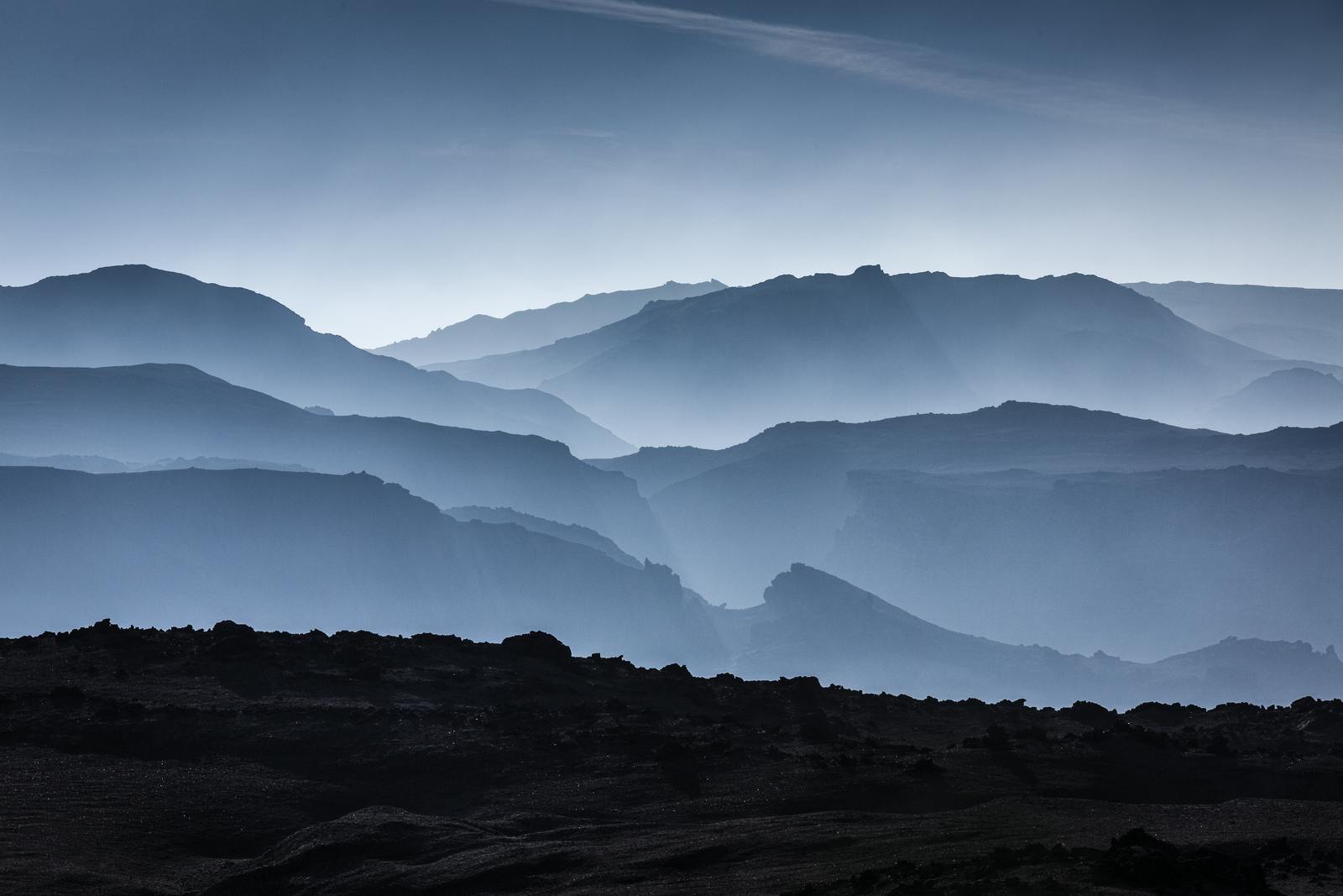
Ódáðahraun is not only the largest lava field in Iceland; it’s the largest desert in Europe, spanning more than 6,000 square kilometres. It is not a single lava, it is formed in many eruptions over a long period of time and composed of hundreds of individual lavas. Black, brown, and grey colours dominate the landscape. Visitors to the area will see endless sand, vast expanses of lava, and fascinating geological formations caused by volcanic activity over the centuries.
The lava shapes range from flat and smooth to rough and jagged. The area gained its name, crime lava, based on lore that numerous criminals hid out in the area trying to elude the authorities.
Where Can You Learn About Volcanoes in Iceland?
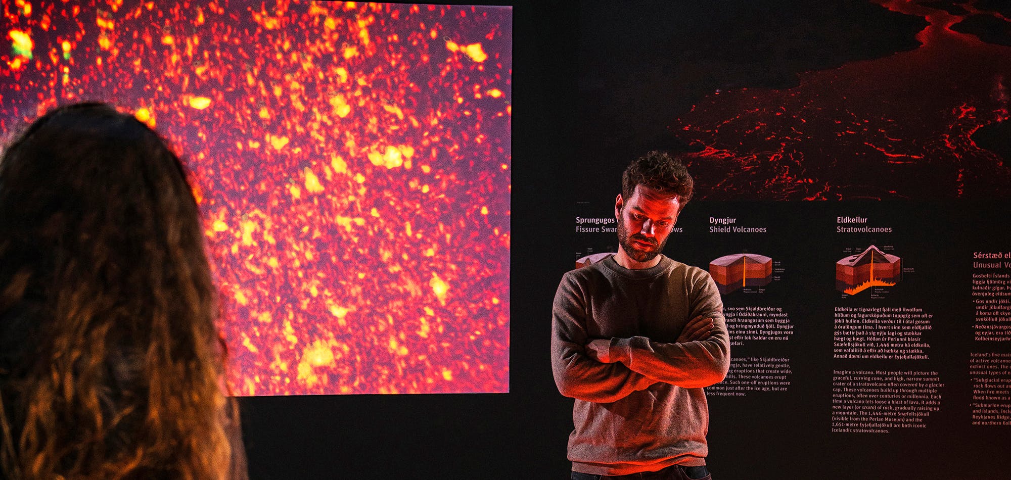
Perlan’s Forces of Nature exhibition allows guests to feel the power of volcanoes, earthquakes, and geothermal energy that powers the island. Guests will learn that volcanoes form when heat and pressure build up beneath the earth’s surface. The earth’s weak points tend to be along fault lines where tectonic plates converge or diverge, as in Iceland’s case.
Perlan’s exhibition shows that volcanic activity in Iceland is so diverse that researchers typically speak of “volcanic systems” rather than individual volcanoes. The island has 30 active volcanic systems, each with many types of volcanoes.
Whether you’re planning a visit or just fascinated by geology, it’s worth checking which active volcanoes Iceland is monitoring closely this year.
FAQ
What would happen if Askja erupted?
The result of an Askja eruption would depend on its size and type. There would likely be earthquakes and sulfurous smells before the eruption, and authorities would issue warnings. Tours to the region would be cancelled, and roads to the area would be closed if warranted.
Geologists constantly monitor the volcanoes on the island, and procedures are in place to keep people safe during a volcanic eruption. There is no need to feel unsafe during a trip to Iceland.
Is Askja safe to visit?
Please note that the volcano is only accessible for a few months of the year due to snow and weather. The roads around Askja are unpaved and rugged F roads. Therefore, you must have a 4WD vehicle with a high undercarriage. It is recommended to first stop at Drekagil’s park ranger station to find out the latest travel conditions at the Viti crater.
Popular articles
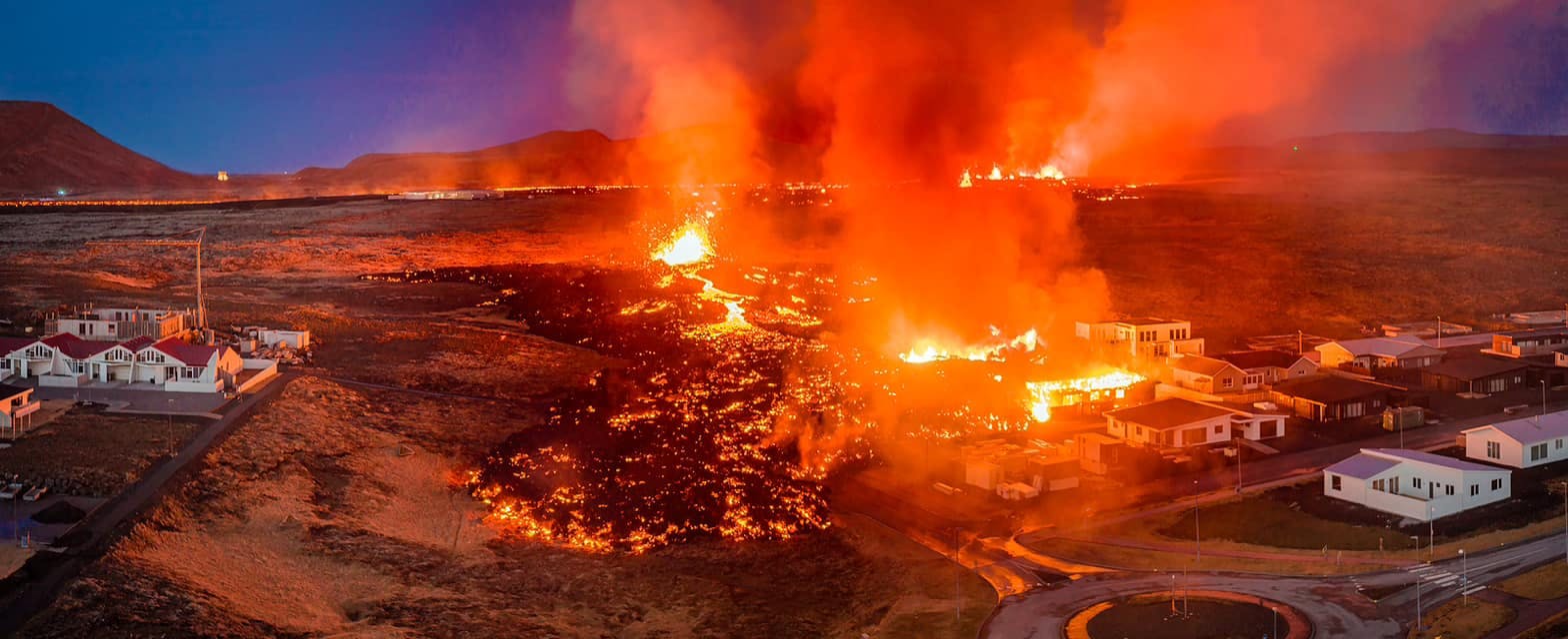
Let's Talk About the Volcano in Iceland About to Erupt
Is a volcano in Iceland about to erupt? Here’s what travelers should know about Svartsengi, Reykjanes activity, flights, safety, and the Blue Lagoon.
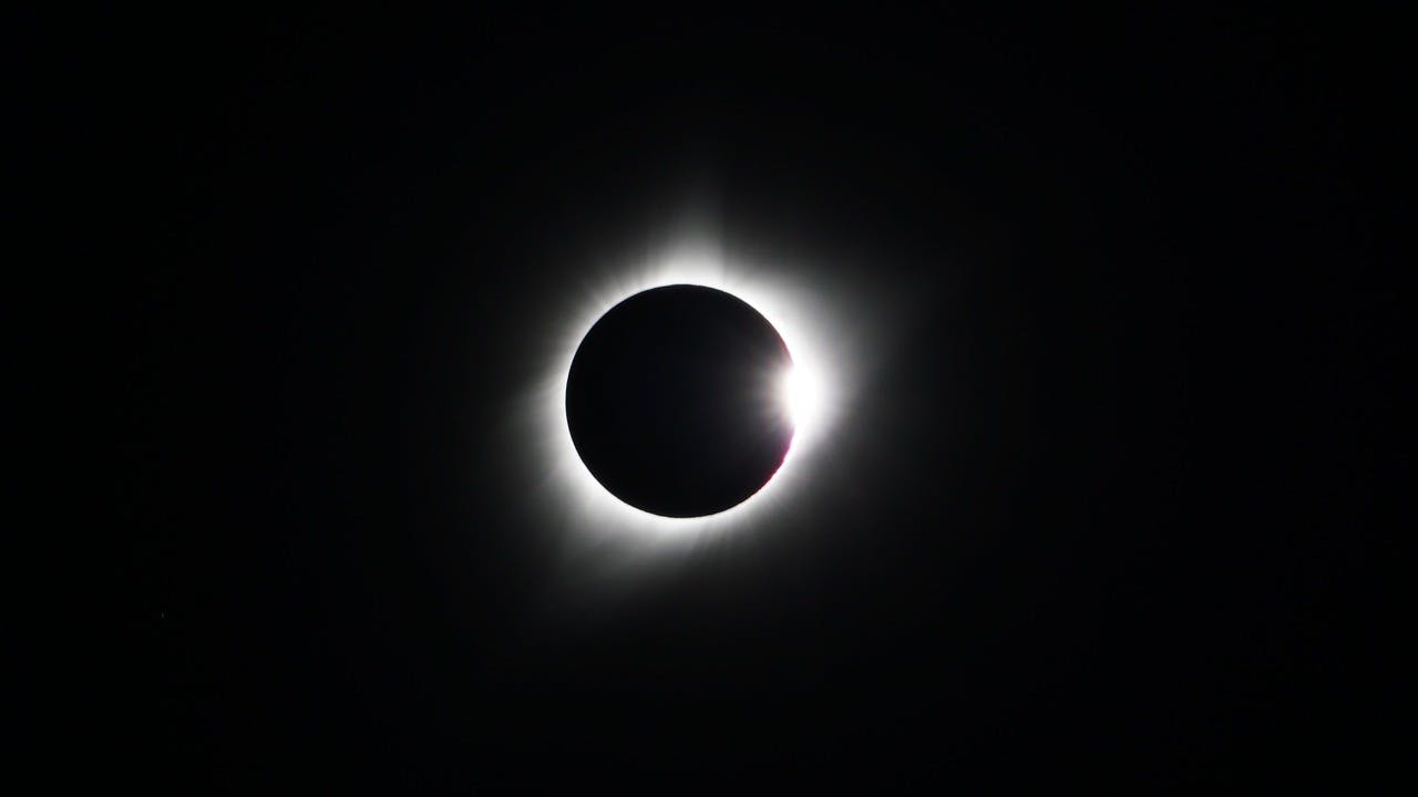
Guide to the Solar Eclipse 2026
Plan your trip to witness the Solar Eclipse 2026 in Iceland! Discover the best viewing spots, key times, safety tips, and travel advice for this rare celestial event.

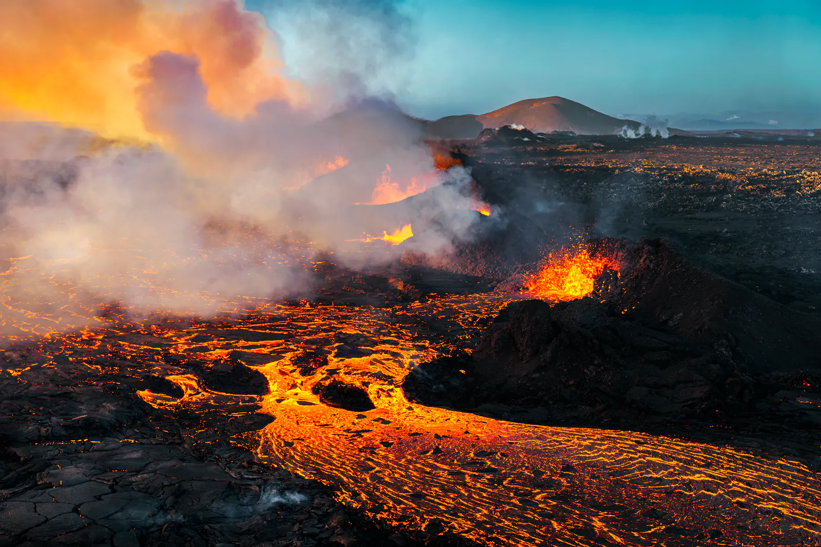
July 2026 updates on the Sundhnúkagígar Eruption in the Reykjanes Peninsula!
The current eruption in the Reykjanes Peninsula, is called Sundhnúkagígar Crater Row. See insights on the seismic activity and volcanic eruptions in the area!
Active Volcanoes in Iceland 2026
Active volcanoes aren't the same thing as active eruptions. A volcano can be considered active even when it is not ejecting ash, rock, gases and magma, so which are active in Iceland in 2026?

Top 10 Places To See the Northern Lights in Iceland
You can see the northern lights across the country, but some spots are more suitable than others. Find the best place to see the northern lights in Iceland.

Ice Caves From Reykjavik
Travel beyond the capital for a closer look at an ice cave under one of Iceland’s glaciers. If you can’t spare the time, experience Perlan’s ice cave in Reykjavik.